
IMAGES TAKEN NEAR TO
Allen Drive, STROUD, GL5 4DT
Introduction
This page details the photographs taken nearby to Allen Drive, GL5 4DT by members of the Geograph project.
The Geograph project started in 2005 with the aim of publishing, organising and preserving representative images for every square kilometre of Great Britain, Ireland and the Isle of Man.

There are currently over 7.5m images from over14,400 individuals and you can help contribute to the project by visiting https://www.geograph.org.uk
Image Map
Images are licensed for reuse under creativecommons.org/licenses/by-sa/2.0
Notes
- Clicking on the map will re-center to the selected point.
- The higher the marker number, the further away the image location is from the centre of the postcode.
Image Listing (48 Images Found)
Images are licensed for reuse under creativecommons.org/licenses/by-sa/2.0
Image
Details
Distance
1
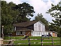
Farmhill Baptist Church
Situated above Mathews Way near its junction with Farmhill Lane. An interesting design - almost circular when seen from the air.
Image: © Derek Harper
Taken: 18 Sep 2008
0.06 miles
2
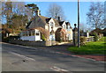
Woodside House, Stroud
Viewed across Farmhill Lane.
Image: © Jaggery
Taken: 15 Jan 2012
0.07 miles
3
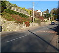
Farmhill Lane, Stroud
Farmhill Lane climbs away from Paganhill towards Whiteshill.
Image: © Jaggery
Taken: 15 Jan 2012
0.08 miles
4
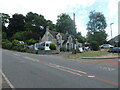
Former lodge to Farmhill House, Stroud
At the southern [downhill] entrance to the estate. Built before 1881.
Image: © Christine Johnstone
Taken: 15 Jul 2022
0.08 miles
5
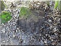
Stone Stile, Stroud
The remains of a stone stile on Gloucestershire footpath ZST34 as it approaches the College and Stratford Park. The footpath would have gone straight on before the new College building and housing were built. The view West is Image
Image: © Mr Red
Taken: 13 Jan 2023
0.09 miles
6
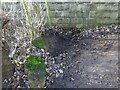
Stone Stile, Stroud
The remains of a stone stile on Gloucestershire footpath ZST34 as it approaches the College and Stratford Park. The footpath would have gone straight on (left of image) before the new College building and housing were built. The view South is Image
Image: © Mr Red
Taken: 13 Jan 2023
0.09 miles
7
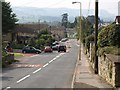
Farmhill Lane, Stroud
This is the road from Whiteshill dropping towards the Paganhill area of Stroud. Traffic is waiting to turn out of Mathews Way.
Image: © Derek Harper
Taken: 18 Sep 2008
0.10 miles
8
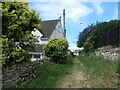
Public footpath to Farmhill Crescent
Heading west from Farmhill Lane.
Image: © Christine Johnstone
Taken: 15 Jul 2022
0.13 miles
9
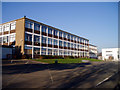
Stroud College
Or "Stroud College in Gloucestershire" as it's officially called, presumably for the benefit of people who don't know where Stroud is. This is the old block of the college, in typical 1960s educational style. On the right they are building a swish new block (I think they demolished an existing building to make room for it): see Image College website: http://www.stroud.ac.uk/index.html
Image: © David Gruar
Taken: 3 Feb 2007
0.14 miles
10
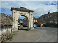
Anti-slavery arch at the entrance to Paganhill estate
The inscription on the arch reads 'Erected to commemorate the abolition of slavery in the British colonies the first of August A.D. MDCCCXXXIV.' A nearby plaque reads ' Stroud Preservation Trust / The Anti Slavery Arch / Built 1834 / by Henry Wyatt / Unique in the UK / Restored 2001'. The arch is listed Grade II* [2*, which is higher than 2].
Image: © Christine Johnstone
Taken: 15 Jul 2022
0.14 miles