1
The Old Crown, Stroud
The Old Crown is a grade II listed Cotswold stone pub in Park End, Paganhill.
Image: © Jaggery
Taken: 15 Jan 2012
0.08 miles
2
Fork in Ruscombe Road, Stroud
Ruscombe Road on the left, a public bridleway on the right.
Image: © Jaggery
Taken: 15 Jan 2012
0.11 miles
3
Private road and public bridleway to Folly Park Farm, Stroud
Viewed from the corner of Ruscombe Road.
Image: © Jaggery
Taken: 15 Jan 2012
0.12 miles
4
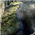
Ruscombe Brook, Stroud
Viewed from Ruscombe Road.
Image: © Jaggery
Taken: 15 Jan 2012
0.13 miles
5
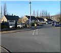
Corner of Mill Farm Drive and Marling Crescent, Stroud
On the left, Marling Crescent heads away from Mill Farm Drive.
Image: © Jaggery
Taken: 15 Jan 2012
0.14 miles
6
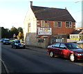
A.S.Cooke, Stroud
Ruscombe Road office of A S Cooke & Co Ltd, building and maintenance contractors, established 1881.
Image: © Jaggery
Taken: 15 Jan 2012
0.14 miles
7
Upfield Close, Stroud
Upfield Close is a private road (no parking, no turning) on the south side of Ruscombe Road.
Image: © Jaggery
Taken: 15 Jan 2012
0.14 miles
8
1-5 Maypole Terrace, Park End, Stroud
A row of five three-storey houses from the early 1800s. Listed Grade II [two].
Image: © Christine Johnstone
Taken: 15 Jul 2022
0.14 miles
9
Ruscombe Road approaches Ruscombe Brook, Stroud
Ruscombe Brook flows under Ruscombe Road at the bend ahead.
Image: © Jaggery
Taken: 15 Jan 2012
0.14 miles
10
Stroud view
General view of Stroud. The clump of buildings in the centre of the picture belong to Archway School. The pair of white lines looking like a giant rugby goal are chimney stacks belonging to the Millikan factory, a wool cloth mill. The hill in the background is Rodborough Hill.
Image: © Peter Kwan
Taken: 13 Mar 2005
0.15 miles


