
IMAGES TAKEN NEAR TO
Whittington, CHELTENHAM, GL54 4HD
Introduction
This page details the photographs taken nearby to GL54 4HD by members of the Geograph project.
The Geograph project started in 2005 with the aim of publishing, organising and preserving representative images for every square kilometre of Great Britain, Ireland and the Isle of Man.

There are currently over 7.5m images from over14,400 individuals and you can help contribute to the project by visiting https://www.geograph.org.uk
Image Map
Images are licensed for reuse under creativecommons.org/licenses/by-sa/2.0
Notes
- Clicking on the map will re-center to the selected point.
- The higher the marker number, the further away the image location is from the centre of the postcode.
Image Listing (43 Images Found)
Images are licensed for reuse under creativecommons.org/licenses/by-sa/2.0
Image
Details
Distance
1
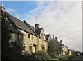
Houses, Whittington
Looking in the opposite direction from Image The nearest pair of cottages are described at http://list.english-heritage.org.uk/resultsingle.aspx?uid=1341363&searchtype=mapsearch .
Image: © Derek Harper
Taken: 25 Oct 2014
0.01 miles
3
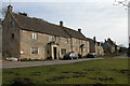
Old School House and Shop, Whittington
Whittington is a quiet village to the north of the busy A40 Cheltenham to Oxford road.
Image: © Philip Halling
Taken: 11 Feb 2006
0.02 miles
4
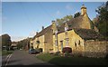
Old buildings, Whittington
On the right is The Old Bakehouse, described at https://historicengland.org.uk/listing/the-list/list-entry/1303111 . Next to it is The Old Shop, described at https://historicengland.org.uk/listing/the-list/list-entry/1089321 . For The Old School House, just beyond, see http://www.britishlistedbuildings.co.uk/en-129236-the-old-school-house-whittington-glouces . For a view looking in the opposite direction, and showing the last of these more clearly, see Image The turning on the left is to the nearby A40.
Image: © Derek Harper
Taken: 25 Oct 2014
0.02 miles
5
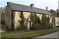
Derelict cottage in Whittington
An unusual sight in a Cotswold village, a derelict cottage. Surprisingly there were also two others in the centre of the village.
Image: © Philip Halling
Taken: 11 Feb 2006
0.03 miles
6
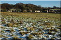
Whittington
Houses in the village of Whittington from near Whittington Court.
Image: © Philip Halling
Taken: 5 Dec 2010
0.05 miles
7
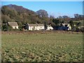
Whittington Village
Houses in Whittington seen from the footpath.
Image: © Michael Dibb
Taken: 17 Dec 2009
0.06 miles
8
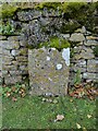
Old Milestone, Ham Road, Whittington
The milestone is located near the north west end of the village, on the grass verge against the wall, on the north east side of the road. Parish of Whittington (Cotswold District). Carved stone post, erected in the 19th century.
National ID: GL_CMWH04
Image: © Roadside Relics
Taken: 21 Nov 2019
0.11 miles
9
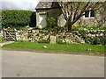
Whittington, milestone
On the Northern verge against a wall. This route was the turnpike via Syreford that was eventually bypassed with the A40 through Andoversford. Image was probably the start of that route.
Inscription: Cheltenham / 4
Milestone Society National ID: tbc
Image: © Mr Red
Taken: 1 Apr 2022
0.11 miles
10
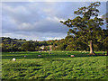
Pastures, Whittington
Looking towards the village from the site of the deserted medieval village.
Image: © Andrew Smith
Taken: 4 Oct 2009
0.12 miles