Old buildings, Whittington
Introduction
The photograph on this page of Old buildings, Whittington by Derek Harper as part of the Geograph project.
The Geograph project started in 2005 with the aim of publishing, organising and preserving representative images for every square kilometre of Great Britain, Ireland and the Isle of Man.

There are currently over 7.5m images from over 14,400 individuals and you can help contribute to the project by visiting https://www.geograph.org.uk
Old buildings, Whittington
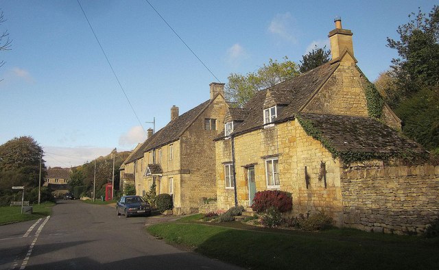
Image: © Derek Harper Taken: 25 Oct 2014
On the right is The Old Bakehouse, described at https://historicengland.org.uk/listing/the-list/list-entry/1303111 . Next to it is The Old Shop, described at https://historicengland.org.uk/listing/the-list/list-entry/1089321 . For The Old School House, just beyond, see http://www.britishlistedbuildings.co.uk/en-129236-the-old-school-house-whittington-glouces . For a view looking in the opposite direction, and showing the last of these more clearly, see Image The turning on the left is to the nearby A40.
Images are licensed for reuse under creativecommons.org/licenses/by-sa/2.0
Image Location


Leaflet Map data © OpenStreetMap
Latitude
51.886926
Longitude
-1.980629