
IMAGES TAKEN NEAR TO
St. Edwards Drive, CHELTENHAM, GL54 1AW
Introduction
This page details the photographs taken nearby to St. Edwards Drive, GL54 1AW by members of the Geograph project.
The Geograph project started in 2005 with the aim of publishing, organising and preserving representative images for every square kilometre of Great Britain, Ireland and the Isle of Man.

There are currently over 7.5m images from over14,400 individuals and you can help contribute to the project by visiting https://www.geograph.org.uk
Image Map
Images are licensed for reuse under creativecommons.org/licenses/by-sa/2.0
Notes
- Clicking on the map will re-center to the selected point.
- The higher the marker number, the further away the image location is from the centre of the postcode.
Image Listing (84 Images Found)
Images are licensed for reuse under creativecommons.org/licenses/by-sa/2.0
Image
Details
Distance
1
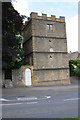
Enoch's Tower, Oddington Road
There is an OS benchmark Image on the front of the tower at the left hand corner, right of an arched gateway with a white door.
Image: © Roger Templeman
Taken: 27 Jun 2015
0.07 miles
2
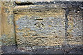
Benchmark on Enoch's Tower
Ordnance Survey cut mark benchmark described on the Bench Mark Database at http://www.bench-marks.org.uk/bm68726
Image: © Roger Templeman
Taken: 27 Jun 2015
0.08 miles
4
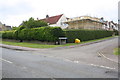
Junction of Oddington Road and Sterling Close
Image: © Roger Templeman
Taken: 27 Jun 2015
0.10 miles
5
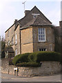
Old Toll House by Park Street, Stow on the Wold
Tollgate in the parish of Stow on the Wold (Cotswold District), Park Street (A436), GL54 1AJ.
Grade II listed.
List Entry Number: 1170724 https://historicengland.org.uk/listing/the-list/list-entry/1170724
Surveyed
Milestone Society National ID: GL.STW01
Image: © Alan Rosevear
Taken: Unknown
0.10 miles
6
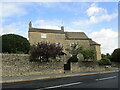
Tollgate House, Stow on the Wold
Dates from the early nineteenth century https://historicengland.org.uk/listing/the-list/list-entry/1170724?section=official-listing
Image: © Jonathan Thacker
Taken: 27 Sep 2021
0.11 miles
8
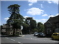
Stow On the Wold
At the junction of Park Street and the road to Maugersbury.
Image: © Ian Rob
Taken: 14 Jun 2009
0.12 miles
10
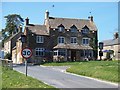
The Bell Inn, Stow-on-the-Wold
The inn is situated between the road to Maugersbury and the A436.
Image: © Michael Dibb
Taken: 21 Apr 2010
0.13 miles