
IMAGES TAKEN NEAR TO
Chandos Road, STROUD, GL5 3QT
Introduction
This page details the photographs taken nearby to Chandos Road, GL5 3QT by members of the Geograph project.
The Geograph project started in 2005 with the aim of publishing, organising and preserving representative images for every square kilometre of Great Britain, Ireland and the Isle of Man.

There are currently over 7.5m images from over14,400 individuals and you can help contribute to the project by visiting https://www.geograph.org.uk
Image Map
Images are licensed for reuse under creativecommons.org/licenses/by-sa/2.0
Notes
- Clicking on the map will re-center to the selected point.
- The higher the marker number, the further away the image location is from the centre of the postcode.
Image Listing (38 Images Found)
Images are licensed for reuse under creativecommons.org/licenses/by-sa/2.0
Image
Details
Distance
1
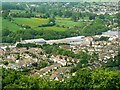
Lightpill, near Stroud
The housing in this image is partly inside this square, that to the left of the diagonal line of trees in the centre of the picture. The commercial/industrial development is west of Dudbridge Road and is outside the square.
Image: © Brian Robert Marshall
Taken: 14 May 2008
0.11 miles
2
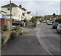
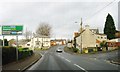
Eros Close, Lightpill
Ascending from the A46 Bath Road.
Image: © Jaggery
Taken: 18 Oct 2015
0.17 miles
3

Stone Stile, Rodborough
The lain remains of a slab stile in a field above Kingscourt Lane. An alternative view taken by the history group for the area - Remembering Roborough ( https://www.rememberingrodborough.org.uk/ ) see Image
Image: © Mr Red
Taken: 10 Dec 2021
0.18 miles
4
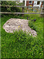
Stone Stile, Rodborough
The recumbent remains of a slab stile in a field above Kingscourt Lane. Taken by the history group for the area - Remembering Rodborough ( https://www.rememberingrodborough.org.uk/ ). The view looking North is Image
Image: © Remembering Rodborough
Taken: 6 Jul 2020
0.18 miles
8
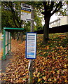
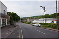
Lightpill bus stop and shelter
Located here http://www.geograph.org.uk/photo/4709337 alongside the A46 Bath Road near the corner of Kitesnest Lane.
Image: © Jaggery
Taken: 18 Oct 2015
0.21 miles
9
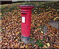
Queen Elizabeth II pillarbox amid dead leaves, Lightpill
A mid-October 2015 view of this http://www.geograph.org.uk/photo/4709337 location.
Image: © Jaggery
Taken: 18 Oct 2015
0.21 miles
10
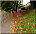
Autumn bank in Lightpill
A mid-October 2015 view of dead leaves on a grassy bank above the A46 Bath Road.
Close together are a red phonebox, red pillarbox http://www.geograph.org.uk/photo/4709331 and green bus shelter.
Image: © Jaggery
Taken: 18 Oct 2015
0.21 miles