
IMAGES TAKEN NEAR TO
Bath Road, STROUD, GL5 3JJ
Introduction
This page details the photographs taken nearby to Bath Road, GL5 3JJ by members of the Geograph project.
The Geograph project started in 2005 with the aim of publishing, organising and preserving representative images for every square kilometre of Great Britain, Ireland and the Isle of Man.

There are currently over 7.5m images from over14,400 individuals and you can help contribute to the project by visiting https://www.geograph.org.uk
Image Map
Images are licensed for reuse under creativecommons.org/licenses/by-sa/2.0
Notes
- Clicking on the map will re-center to the selected point.
- The higher the marker number, the further away the image location is from the centre of the postcode.
Image Listing (193 Images Found)
Images are licensed for reuse under creativecommons.org/licenses/by-sa/2.0
Image
Details
Distance
1
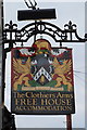
Clothier Arms on Bath Road, Stroud
http://www.geograph.org.uk/photo/5008179
Image: © Ian S
Taken: 27 May 2016
0.01 miles
2
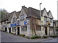
The Clothiers Arms
Stroud has a long history in the wool trade so not surprisingly there is a reminder.
Image: © Neil Owen
Taken: 25 Nov 2013
0.01 miles
3
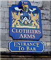
The Clothiers Arms heraldic name sign, Rodborough Stroud
Over a doorway here. http://www.geograph.org.uk/photo/4292494
Image: © Jaggery
Taken: 28 Dec 2014
0.01 miles
4
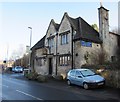
The Clothiers Arms, Rodborough, Stroud
Pub with accommodation and restaurant viewed across the A46 Bath Road in the parish of Rodborough.
Image: © Jaggery
Taken: 28 Dec 2014
0.01 miles
5
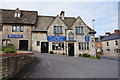
Clothier Arms on Bath Road, Stroud
http://www.geograph.org.uk/photo/5008184
Image: © Ian S
Taken: 27 May 2016
0.01 miles
6
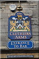
Clothier Arms on Bath Road, Stroud
http://www.geograph.org.uk/photo/5008179
Image: © Ian S
Taken: 27 May 2016
0.01 miles
7
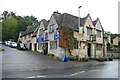
The Clothiers Arms, Stroud
A public house on the A46 Bath Road and overlooking Lodgemore Mill.
Image: © Chris Allen
Taken: 27 Oct 2013
0.01 miles
9
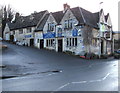
The Clothiers Arms, Rodborough, Stroud
Pub with accommodation and restaurant viewed across the A46 Bath Road in the parish of Rodborough.
Image: © Jaggery
Taken: 28 Dec 2014
0.01 miles
10
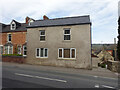
Toll House, Stroud
On the Bath Road opposite the Clothiers Arms. Served the Lightpill and Birdlip Turnpike Trust. Former Toll Houses often include a name like Pike or Toll/Tollgate. However the house does not bear a name plate, and a Gloucestershire County Council map merely notes a number. Served the Nailsworth, Woodchester and Dudbridge Turnpike Trust.
Milestone Society National ID: GL.STR02
Image: © Mr Red
Taken: 11 Apr 2022
0.02 miles