
IMAGES TAKEN NEAR TO
Lodgemore Close, STROUD, GL5 3HU
Introduction
This page details the photographs taken nearby to Lodgemore Close, GL5 3HU by members of the Geograph project.
The Geograph project started in 2005 with the aim of publishing, organising and preserving representative images for every square kilometre of Great Britain, Ireland and the Isle of Man.

There are currently over 7.5m images from over14,400 individuals and you can help contribute to the project by visiting https://www.geograph.org.uk
Image Map
Images are licensed for reuse under creativecommons.org/licenses/by-sa/2.0
Notes
- Clicking on the map will re-center to the selected point.
- The higher the marker number, the further away the image location is from the centre of the postcode.
Image Listing (179 Images Found)
Images are licensed for reuse under creativecommons.org/licenses/by-sa/2.0
Image
Details
Distance
1

Cainscross Rd
This brick built apartment block is on Cainscross Rd opposite the junction with Gannicox Rd.
Image: © Nigel Mykura
Taken: 7 Oct 2011
0.03 miles
2
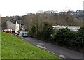
Lodgemore Lane, Stroud
Lodgemore Lane descends from Cainscross Road towards the Stroudwater Canal.
Image: © Jaggery
Taken: 17 Feb 2013
0.04 miles
3
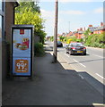
McDonald's advert on a BT phonebox, Cainscross Road, Stroud
Image: © Jaggery
Taken: 7 May 2017
0.04 miles
4
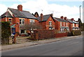
Cainscross Road houses, Stroud
On the north side of the road, between Lodgemore Lane and Gannicox Road.
Image: © Jaggery
Taken: 17 Feb 2013
0.04 miles
5
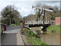
New asymmetric lift-bridge, Stroud
Carrying Lodgemore Lane over the Stroudwater Navigation, and providing access for Lodgemore Mills' trucks.
Image: © Christine Johnstone
Taken: 28 Mar 2016
0.04 miles
6
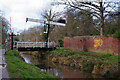
Lodgemoor Lane Lift Bridge, Stroudwater Navigation
Until the canal was abandoned a lift bridge was sited here adjacent to Lodgemoor Mill; this was replaced by a fixed structure. However, a lift bridge has now been reinstated as part of the restoration project.
Image: © Stephen McKay
Taken: 4 Feb 2022
0.04 miles
7
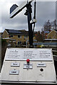
Control panel - Lodgemoor Lane Lift Bridge
The control panel is used by boaters to raise and lower the lift bridge over the Stroudwater Navigation. The bridge was formerly a fixed structure but has been reinstated as an operational lift bridge as part of the canal restoration project.
Image: © Stephen McKay
Taken: 4 Feb 2022
0.04 miles
8
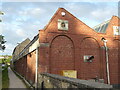
Lodgemore Mill, Stroud
This is one of the very few working textile mills in the south-west and specialises in green baize and tennis ball covers. The Stroudwater Canal runs alongside on the left.
Image: © Chris Allen
Taken: 14 Jun 2018
0.04 miles
9
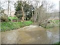
Painswick Stream entering the Stroudwater Navigation
It had rained heavily yesterday. Compare with Image taken eight years earlier.
Image: © Christine Johnstone
Taken: 28 Mar 2016
0.05 miles
10
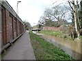
Stroudwater Navigation at Lodgemore Mills, Stroud
With a disused gas pipe running alongside the towpath.
Image: © Christine Johnstone
Taken: 28 Mar 2016
0.05 miles