1
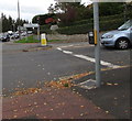
Fenced off former police station site, Rodborough, Stroud
In October 2015, temporary fencing encloses the site of the demolished
Rodborough Police Station on the corner of the A46 Bath Road and Dudbridge Hill.
Image: © Jaggery
Taken: 18 Oct 2015
0.06 miles
2
Top of Dudbridge Hill, Rodborough, Stroud
Dudbridge Hill descends towards Dudbridge from the A46 Bath Road.
Image: © Jaggery
Taken: 18 Oct 2015
0.07 miles
3
Dudbridge hill
Image: © norman hyett
Taken: 17 Oct 2009
0.08 miles
4
Over Stroud to Doverow Hill - Gloucestershire
Looking out across Stroud from Rodborough Common towards Doverow Hill and the Severn. This shows the expansion of Stroud from what was once a hamlet, a chapelry of nearby Bisley, to its present status as a town and centre of communications in its own right. Time taken 5.59 pm BST (British Summer Time).
Image: © Martin Richard Phelan
Taken: 16 Aug 2008
0.08 miles
5
Golden Cross name sign, Stroud
The small name sign on the left is alongside the A46 Bath Road at the Dudbridge Hill junction.
Image: © Jaggery
Taken: 18 Oct 2015
0.09 miles
6
A46 northbound
Image: © Alex McGregor
Taken: 11 Dec 2014
0.10 miles
7
Turn right here for Rodborough and Minchinhampton
On the corner of the A46 Bath Road in Stroud, a sign points right
up Walkley Hill towards Rodborough and Minchinhampton (3½ miles).
Image: © Jaggery
Taken: 18 Oct 2015
0.10 miles
8
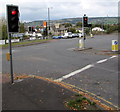
Red lights at the bottom of Walkley Hill, Stroud
Traffic lights control the busy crossroads of Walkley Hill, Dudbridge Hill and the A46 Bath Road.
Image: © Jaggery
Taken: 18 Oct 2015
0.10 miles
9
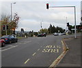
Queueing on the A46 Bath Road, Stroud
Traffic stopped at red lights at the Dudbridge Hill and Walkley Hill crossroads.
Image: © Jaggery
Taken: 18 Oct 2015
0.10 miles
10
Overhead traffic lights, Stroud
On the corner of the A46 Bath Road and Walkley Hill.
Image: © Jaggery
Taken: 18 Oct 2015
0.10 miles


