
IMAGES TAKEN NEAR TO
Moorend Road, CHELTENHAM, GL53 9BH
Introduction
This page details the photographs taken nearby to Moorend Road, GL53 9BH by members of the Geograph project.
The Geograph project started in 2005 with the aim of publishing, organising and preserving representative images for every square kilometre of Great Britain, Ireland and the Isle of Man.

There are currently over 7.5m images from over14,400 individuals and you can help contribute to the project by visiting https://www.geograph.org.uk
Image Map
Images are licensed for reuse under creativecommons.org/licenses/by-sa/2.0
Notes
- Clicking on the map will re-center to the selected point.
- The higher the marker number, the further away the image location is from the centre of the postcode.
Image Listing (19 Images Found)
Images are licensed for reuse under creativecommons.org/licenses/by-sa/2.0
Image
Details
Distance
1
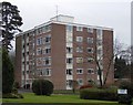
Withyholt Court, Moorend Road, Cheltenham
This 1960s development is not in keeping with the rest of the housing in this area. There is a second (identical) block behind and to the left of the one in the picture, partly hidden by trees.
Image: © Terry Jacombs
Taken: 23 Jan 2009
0.10 miles
2
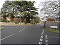
Sandy Lane, Greenhills Road, Moorend Road junction
This junction gets blocked up during the morning rush hour as the Charlton Kings schools traffic clashes with commuters travelling into and round Cheltenham
Image: © Terry Jacombs
Taken: 27 Jan 2009
0.10 miles
3
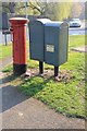
Pillar Box and Post Office storage cabinets, Greenhills Road/Sandy Lane
Image: © Terry Jacombs
Taken: 23 Mar 2012
0.10 miles
4
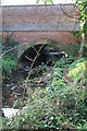
Moorend Road bridge over the Lilley Brook
Image: © Terry Jacombs
Taken: 23 Mar 2012
0.10 miles
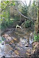
6
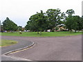
Charlton Park Green
The Charlton Park estate is built on land purchased from Charlton Park Convent, originally a large house and estate built in the 18th century. The plaque on the green is an engraving of the house as it was in the eighteen hundreds with some historical information.
Image: © Terry Jacombs
Taken: 4 Aug 2005
0.12 miles
7
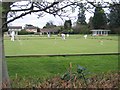
Cheltenham Croquet Club
Located on the Old Bath Road near Naunton Park, the Cheltenham Croquet Club is one of the oldest and best equipped in the country. It is the home of the Croquet Association and has hosted Test Matches and even the World Championships.
Image: © Stephen Bowden
Taken: 16 Apr 2005
0.12 miles
8
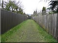
Moorend Road to Greatfield Drive footpath
The path provides access to the Old Patesian's playing fields and onwards to Leckhampton hill which can be seen in the far background
Image: © Terry Jacombs
Taken: 17 Feb 2009
0.13 miles
9
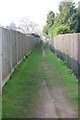
Greenhills Road to Greatfield Drive footpath
Image: © Terry Jacombs
Taken: 23 Mar 2012
0.17 miles
10
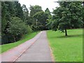
Charlton Park Foot and Cycle Paths
The foot and cycle paths provide a traffic free route (apart from crossing a couple of roads) from the edge of Charlton Kings to the centre of Cheltenham.
Image: © Terry Jacombs
Taken: 4 Aug 2005
0.17 miles