
IMAGES TAKEN NEAR TO
Moorend Glade, CHELTENHAM, GL53 9AT
Introduction
This page details the photographs taken nearby to Moorend Glade, GL53 9AT by members of the Geograph project.
The Geograph project started in 2005 with the aim of publishing, organising and preserving representative images for every square kilometre of Great Britain, Ireland and the Isle of Man.

There are currently over 7.5m images from over14,400 individuals and you can help contribute to the project by visiting https://www.geograph.org.uk
Image Map
Images are licensed for reuse under creativecommons.org/licenses/by-sa/2.0
Notes
- Clicking on the map will re-center to the selected point.
- The higher the marker number, the further away the image location is from the centre of the postcode.
Image Listing (57 Images Found)
Images are licensed for reuse under creativecommons.org/licenses/by-sa/2.0
Image
Details
Distance
1
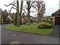
Moorend Glade, Charlton Kings
A small development of late 1980s "executive" houses built in the grounds once part of St Edwards convent.
Image: © Terry Jacombs
Taken: 27 Jan 2009
0.03 miles
2
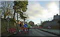
Roadworks on Moorend Road
The roadworks were for the construction of a roundabout where two cul-de-sacs met the Moorend Road. Totally unnecessary in view of many of the local residents.
Image: © Steve Fareham
Taken: 10 Dec 2008
0.08 miles
3
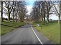
St Edwards Senior School main entrance drive and grounds
The long entrance drive sweeps down from the Cirencester Road to the main school buildings round the bend to the left at the far end of the drive.
Image: © Terry Jacombs
Taken: 22 Feb 2009
0.09 miles
5
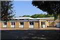
Sacred Hearts Hall and Squash Club
The modern Sacred Hearts Catholic church has this rather nondescript parish hall and curiously, squash court adjacent to it.
Image: © Terry Jacombs
Taken: 23 May 2012
0.10 miles
6
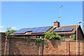
Solar Panels
Seen from Newcourt Road, an increasing number of homes around here are now sporting solar panels.
Image: © Terry Jacombs
Taken: 27 Jul 2012
0.10 miles
7
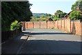
Newcourt Road
The old brick wall was originally the boundary of the Moorend Park Hotel grounds, long since replaced with a 1980s housing estate.
Image: © Terry Jacombs
Taken: 27 Jul 2012
0.10 miles
8
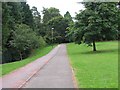
Charlton Park Foot and Cycle Paths
The foot and cycle paths provide a traffic free route (apart from crossing a couple of roads) from the edge of Charlton Kings to the centre of Cheltenham.
Image: © Terry Jacombs
Taken: 4 Aug 2005
0.10 miles
9
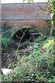
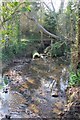
Moorend Road bridge over the Lilley Brook
Image: © Terry Jacombs
Taken: 23 Mar 2012
0.11 miles
10
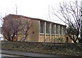
Sacred Hearts Roman Catholic Church, Charlton Kings
The church was completed in 1957.
Image: © Terry Jacombs
Taken: 23 Jan 2009
0.12 miles