
IMAGES TAKEN NEAR TO
Beeches Road, CHELTENHAM, GL53 8NY
Introduction
This page details the photographs taken nearby to Beeches Road, GL53 8NY by members of the Geograph project.
The Geograph project started in 2005 with the aim of publishing, organising and preserving representative images for every square kilometre of Great Britain, Ireland and the Isle of Man.

There are currently over 7.5m images from over14,400 individuals and you can help contribute to the project by visiting https://www.geograph.org.uk
Image Map
Images are licensed for reuse under creativecommons.org/licenses/by-sa/2.0
Notes
- Clicking on the map will re-center to the selected point.
- The higher the marker number, the further away the image location is from the centre of the postcode.
Image Listing (14 Images Found)
Images are licensed for reuse under creativecommons.org/licenses/by-sa/2.0
Image
Details
Distance
1
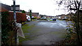
Beeches Road
Viewed from the footpath that leads from the end of the cul-de-sac.
We're at the south-eastern edge of the Cheltenham conurbation where we run up against the ramparts of Wistley Hill.
Image: © Jonathan Billinger
Taken: 12 Dec 2014
0.02 miles
2
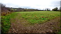
Dog-walking field
This is the same place as the first for the square taken nine and a half years previously, see Image
Image: © Jonathan Billinger
Taken: 12 Dec 2014
0.11 miles
3
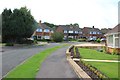
Ravensgate Road (west)
Ravensgate Road is part of the Beeches Estate a 1960s/1970s development on the southern side of Charlton Kings.
Image: © Terry Jacombs
Taken: 27 Jul 2012
0.11 miles
4
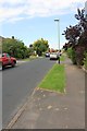
Beeches Road
Beeches Road is part of the Beeches Estate a 1960s/1970s development on the southern side of Charlton Kings.
Image: © Terry Jacombs
Taken: 27 Jul 2012
0.18 miles
5
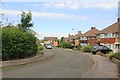
Wistley Road
Wistley Road is part of the Beeches Estate a 1960s/1970s development on the southern side of Charlton Kings.
Image: © Terry Jacombs
Taken: 27 Jul 2012
0.19 miles
6
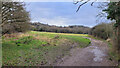
Footpath onto the hillside
From the end of Balcarras Road, the path begins the ascent of Wistley Hill.
Very popular dog-walking route.
Image: © Jonathan Billinger
Taken: 31 Jan 2022
0.19 miles
7
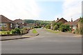
Ravensgate Road (north)
Ravensgate Road is part of the Beeches Estate a 1960s/1970s development on the southern side of Charlton Kings. Hartley Hill/Leckhampton Hill visible in the background.
Image: © Terry Jacombs
Taken: 27 Jul 2012
0.19 miles
8
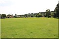
Beeches Recreation Ground
The Beeches Recreation Ground is the main public open space in Charlton Kings.
Image: © Terry Jacombs
Taken: 27 Jul 2012
0.20 miles
9
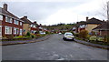
Wistley Road
Part of the Little Herbert's estate on the southern edge of Cheltenham.
Wistley Hill rises up beyond.
Image: © Jonathan Billinger
Taken: 12 Dec 2014
0.20 miles
10
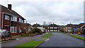
Ravensgate Road
Part of the Little Herbert's estate on the southern edge of Cheltenham.
Image: © Jonathan Billinger
Taken: 12 Dec 2014
0.20 miles