
IMAGES TAKEN NEAR TO
Churchill Road, CHELTENHAM, GL53 7EG
Introduction
This page details the photographs taken nearby to Churchill Road, GL53 7EG by members of the Geograph project.
The Geograph project started in 2005 with the aim of publishing, organising and preserving representative images for every square kilometre of Great Britain, Ireland and the Isle of Man.

There are currently over 7.5m images from over14,400 individuals and you can help contribute to the project by visiting https://www.geograph.org.uk
Image Map
Images are licensed for reuse under creativecommons.org/licenses/by-sa/2.0
Notes
- Clicking on the map will re-center to the selected point.
- The higher the marker number, the further away the image location is from the centre of the postcode.
Image Listing (52 Images Found)
Images are licensed for reuse under creativecommons.org/licenses/by-sa/2.0
Image
Details
Distance
1
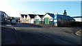
Churchill Industrial Estate, Churchill Road
Typical of several small industrial sites on the southern side of Cheltenham, it lies right on the edge of the square, the photograph was taken from just in square SO9520
Image: © Terry Jacombs
Taken: 18 Jan 2009
0.03 miles
2
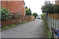
Badminton Close
A small business and three or four bungalows are at the end of this short road.
Image: © Terry Jacombs
Taken: 4 Jul 2012
0.07 miles
3
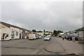
Mead Road Commercial Area
A builder's merchant and bathroom and kitchen store are among the businesses here.
Image: © Terry Jacombs
Taken: 4 Jul 2012
0.08 miles
4
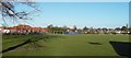
Naunton Park Playing Fields and Playground
The playing fields host three football pitches during the football season. Naunton Park School can be seen behind the playground areas.
Image: © Terry Jacombs
Taken: 18 Jan 2009
0.08 miles
5
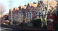
Naunton Park School
Now a primary and junior school, until the late 1960s there was also a senior school here.
Image: © Terry Jacombs
Taken: 18 Jan 2009
0.08 miles
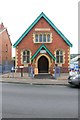
7
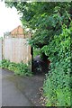
Mead Road to Old Bath Road footpath
Overgrown and muddy entrance in the wet summer of 2012
Image: © Terry Jacombs
Taken: 4 Jul 2012
0.09 miles
8
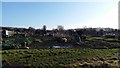
Asquith Road Allotments
The allotments cover all the ground south of Naunton Park between the Old Bath Road and Asquith Road.
Image: © Terry Jacombs
Taken: 18 Jan 2009
0.10 miles
9
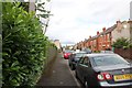
Fairfield Parade
This area of southern Cheltenham between Leckhampton Road and Naunton Park has several streets of early twentieth century housing.
Image: © Terry Jacombs
Taken: 4 Jul 2012
0.11 miles
10

Naunton Park School Foundation Stone
Image: © Terry Jacombs
Taken: 18 Jan 2009
0.12 miles