1
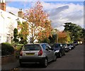
Whitecross Square
Hidden away off Naunton Lane this short road of mixed early to middle 1900s housing is right on the north edge of the square.
Image: © Terry Jacombs
Taken: 20 Jan 2009
0.02 miles
2
White Cross Square
White Cross Square and the surrounding area of Naunton Park and Crescent is one of the most picturesque and well maintained areas of Cheltenham.
Image: © Helen Iwanczuk
Taken: 19 Oct 2010
0.04 miles
3
Naunton Lane looking south west
Leads to an early 1900s residential area. On the left is Linton House, once a private house, now a cancer treatment centre. On the right are the grounds of Cheltenham College.
Image: © Terry Jacombs
Taken: 20 Jan 2009
0.05 miles
4
Church of Jesus Christ of Latter-Day Saints
One of the churches family history research centres is housed here.
Image: © Terry Jacombs
Taken: 18 Jan 2009
0.06 miles
5
Cheltenham - Thirlestaine Road
Image: © Peter Whatley
Taken: 21 May 2011
0.08 miles
6
Cobalt House
This elegant villa has had a long history of service to the public. It was Sandford School during the late 1960's up until 1976 when the School moved to Seven Springs. It is now Thirlestaine Breast centre, a unit which provides cutting edge technology in the fight against breast cancer. Princess Anne opened the centre in March 2010.
Image: © Helen Iwanczuk
Taken: Unknown
0.08 miles
7
The Verneys, Cheltenham
I don't know for sure, but my guess would be that this small residential cul de sac branching off Old Bath Road in Cheltenham, is named for the Buckinghamshire family who fought for both sides in the English Civil War and who were later related by marriage to Florence Nightingale. But as I say, I may be wrong about that.
Image: © John Winder
Taken: 24 Aug 2014
0.08 miles
8
Park House, Thirlestaine Road
Park House dates from the early 1800s. It is listed in Slaters 1858/59 directory. The addition on the right hand side has not enhanced it. In recent years it has been used for both residential and commercial purposes.
Image: © Terry Jacombs
Taken: 20 Jan 2009
0.11 miles
9
Cheltenham College Playing Fields
One of the three playing field areas at the college. These ones extend into squares SO9521 and SO9421
Image: © Terry Jacombs
Taken: 18 Jan 2009
0.11 miles
10
Hays Cottages Almshouses, Naunton Park
The almshouses were built in the early 20th century and are still administered by the Hays Trust
Image: © Terry Jacombs
Taken: 18 Jan 2009
0.12 miles


