
IMAGES TAKEN NEAR TO
Knapp Lane, STROUD, GL5 2TJ
Introduction
This page details the photographs taken nearby to Knapp Lane, GL5 2TJ by members of the Geograph project.
The Geograph project started in 2005 with the aim of publishing, organising and preserving representative images for every square kilometre of Great Britain, Ireland and the Isle of Man.

There are currently over 7.5m images from over14,400 individuals and you can help contribute to the project by visiting https://www.geograph.org.uk
Image Map
Images are licensed for reuse under creativecommons.org/licenses/by-sa/2.0
Notes
- Clicking on the map will re-center to the selected point.
- The higher the marker number, the further away the image location is from the centre of the postcode.
Image Listing (32 Images Found)
Images are licensed for reuse under creativecommons.org/licenses/by-sa/2.0
Image
Details
Distance
1
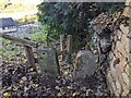
Stone Stile near Wimberley Mills, Minchinhampton GS1457
Stone Squeeze Through stile off Knapp Lane and just up the hill from Wimberley Mills. On public right of way MMH156
Image: © Gisela Blee
Taken: 21 Nov 2021
0.01 miles
2
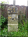
Milestone at Wimberley Mills
on the towpath of the Thames & Severn canal
Walbridge 3 / Inglesham 25¾
Milestone Society National ID: TSC-03
Image: © Mr Red
Taken: 18 Apr 2019
0.07 miles
3
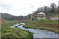
Wimberley Park
Development land near the River Frome in Brimscombe.
Image: © Wayland Smith
Taken: 7 Mar 2020
0.08 miles
4
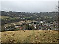
Wimberley Mills Housing Development, Brimscombe
Slow progress at the Wimberley Mills development viewed from Blackness.
Image: © J I Cheetham
Taken: 2 Mar 2024
0.09 miles
5
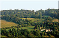
The Knapp, Brimscombe
Knapp Lane Brimscombe viewed from Quarhouse Lane, Brimscombe
Image: © Roger May
Taken: 14 Aug 2001
0.09 miles
6
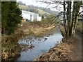
Thames and Severn Canal
A disused section of the Thames and Severn Canal near Brimscombe.
Image: © Philip Halling
Taken: 12 Mar 2016
0.10 miles
7
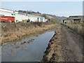
Industrial buildings beside the canal
Industrial buildings beside the disused Thames and Severn Canal near Brimscombe.
Image: © Philip Halling
Taken: 12 Mar 2016
0.10 miles
8
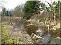
Disused Thames and Severn Canal
Further down the valley this canal has undergone restoration though this part of the Thames and Severn Canal east of Brimscombe is very much choked with silt and vegetation.
Image: © Philip Halling
Taken: 12 Mar 2016
0.10 miles
9
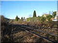
Site of Brimscombe Station
This view of the Swindon - Gloucester railway line from the footpath crossing at Brimscombe shows all that is left (i.e. nothing!) of the former Brimscombe Station. The bushes on either side mark the site of the platforms of what was a complete station, complete with footbridge, signal boxes and good yard. Compare with https://en.wikipedia.org/wiki/File:Brimscombe_railway_station_1908506.jpg also taken looking down the valley towards Stroud but from the station footbridge which would have crossed the tracks in the foreground of the photo above.
Image: © David Stowell
Taken: 30 Jan 2008
0.12 miles
10
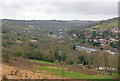
Hyde towards Burleigh
View across the Cotswolds.
Image: © Wayland Smith
Taken: 7 Mar 2020
0.12 miles