
IMAGES TAKEN NEAR TO
Station Road, CHELTENHAM, GL52 9HR
Introduction
This page details the photographs taken nearby to Station Road, GL52 9HR by members of the Geograph project.
The Geograph project started in 2005 with the aim of publishing, organising and preserving representative images for every square kilometre of Great Britain, Ireland and the Isle of Man.

There are currently over 7.5m images from over14,400 individuals and you can help contribute to the project by visiting https://www.geograph.org.uk
Image Map
Images are licensed for reuse under creativecommons.org/licenses/by-sa/2.0
Notes
- Clicking on the map will re-center to the selected point.
- The higher the marker number, the further away the image location is from the centre of the postcode.
Image Listing (16 Images Found)
Images are licensed for reuse under creativecommons.org/licenses/by-sa/2.0
Image
Details
Distance
1
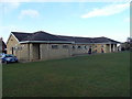
Woodmancote Sports Pavilion/Community Centre
Situated on the cricket/sports field in the middle of the village.
Image: © Terry Jacombs
Taken: 24 Feb 2012
0.06 miles
2
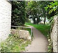
Stone Stile, Bishops Cleeve
On Gloucestershire footpath AWO14 looking towards the recreation ground and cricket pitch. The view facing in the direction of Station Road is Image
Image: © Pete Dempsey
Taken: 10 Jul 2021
0.10 miles
3
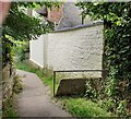
Stone Stile, Bishops Cleeve
On Gloucestershire footpath AWO14 looking in the direction of Station Road. The view facing towards the recreation ground and cricket pitch is Image
Image: © Pete Dempsey
Taken: 10 Jul 2021
0.10 miles
4
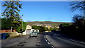
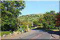
New Road, Woodmancote Green
Complete with vintage Landrover.
Woodmancote is a suburb of Bishop's Cleeve, itself a dormitory for Cheltenham.
Image: © Jonathan Billinger
Taken: 30 Jan 2016
0.12 miles
6
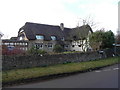
Thatched Cottage, Woodmancote
Situated at the junction of New Road, Station Road and Stockwell Lane, the cottage is in the middle of the old village.
Image: © Terry Jacombs
Taken: 24 Feb 2012
0.15 miles
7
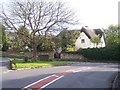
Kings Farm, Woodmancote
One of the older buildings in what is now a crowded urban environment.
Image: © Bob Embleton
Taken: 14 Nov 2005
0.15 miles
8

Stone Stile, Woodmancote
Off Boscombe Lane looking from Gloucestershire footpath AWO30 to the road. The view from the road is Image
Image: © Mr Red
Taken: 22 Jan 2022
0.18 miles
9

Stone Stile, Woodmancote
Looking from Boscombe Lane to Gloucestershire footpath AWO30. The view from the footpath is Image
Image: © Mr Red
Taken: 22 Jan 2022
0.18 miles
10
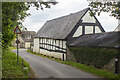
Yew Tree Farm
Listed building description: Barn/stable. C17. Square-panelled timber-framing and coursed rubble; slate roof. Rectangular plan to timber-framed part; stone-built extension to the south-west gable end. Single-storey extension to the north-east gable end not of special interest. Double plank door to the north-facing elevation; high stable door to the left. Pitching window and stable door to the stone-built part. Interior: 4 bays with the original roof timbers with queen struts; timber-framed former gable end wall retained where stone-built extension was added.
Image: © P Gaskell
Taken: Unknown
0.21 miles