
IMAGES TAKEN NEAR TO
Greenfield Drive, CHELTENHAM, GL52 8FQ
Introduction
This page details the photographs taken nearby to Greenfield Drive, GL52 8FQ by members of the Geograph project.
The Geograph project started in 2005 with the aim of publishing, organising and preserving representative images for every square kilometre of Great Britain, Ireland and the Isle of Man.

There are currently over 7.5m images from over14,400 individuals and you can help contribute to the project by visiting https://www.geograph.org.uk
Image Map
Images are licensed for reuse under creativecommons.org/licenses/by-sa/2.0
Notes
- Clicking on the map will re-center to the selected point.
- The higher the marker number, the further away the image location is from the centre of the postcode.
Image Listing (7 Images Found)
Images are licensed for reuse under creativecommons.org/licenses/by-sa/2.0
Image
Details
Distance
1
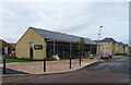
Co-operative food store on Vale Road, Bishop's Cleeve
Image: © JThomas
Taken: 13 Aug 2021
0.20 miles
2
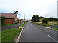
Gotherington Lane, Bishop's Cleeve
The village is still expanding to the left.
Image: © JThomas
Taken: 13 Aug 2021
0.23 miles
3
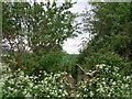
Parish boundary between Gotherington and Bishop's Cleeve
The ditch forms the boundary. The church of Bishop's Cleeve, visible on the horizon, is in square SO9627.
Image: © Liz Stone
Taken: 4 Jun 2012
0.23 miles
4
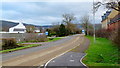
The Old Evesham Road
Looking south towards the dormitory town of Bishop's Cleeve and the Cotswold scarp beyond.
Image: © Jonathan Billinger
Taken: 25 Jan 2012
0.23 miles
5
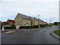
New housing on Gotherington Lane, Bishop's Cleeve
Image: © JThomas
Taken: 13 Aug 2021
0.24 miles
6
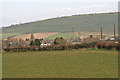
Homelands farm buildings with Oxenton hill beyond
Fields may soon be built on.
Image: © Paul Makepeace
Taken: 10 Mar 2007
0.24 miles
7
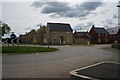
New houses off Gotherington Lane, Bishops Cleeve
Image: © Ian S
Taken: 21 May 2014
0.25 miles