
IMAGES TAKEN NEAR TO
Stanley Road, CHELTENHAM, GL52 6QD
Introduction
This page details the photographs taken nearby to Stanley Road, GL52 6QD by members of the Geograph project.
The Geograph project started in 2005 with the aim of publishing, organising and preserving representative images for every square kilometre of Great Britain, Ireland and the Isle of Man.

There are currently over 7.5m images from over14,400 individuals and you can help contribute to the project by visiting https://www.geograph.org.uk
Image Map
Images are licensed for reuse under creativecommons.org/licenses/by-sa/2.0
Notes
- Clicking on the map will re-center to the selected point.
- The higher the marker number, the further away the image location is from the centre of the postcode.
Image Listing (11 Images Found)
Images are licensed for reuse under creativecommons.org/licenses/by-sa/2.0
Image
Details
Distance
3
Footpath in the Battledown Estate
A way of walking down Battledown Hill without having to go on the road.
Image: © Bill Boaden
Taken: 25 May 2018
0.11 miles
5
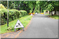
Roadworks on Oakley Road
Some pipeline works have been undertaken by Wales & West Utilities, now nearing completion. This is a private road in the Battledown Estate: http://battledown.co.uk/history.asp
Image: © Bill Boaden
Taken: 25 May 2018
0.11 miles
6
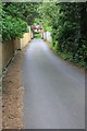
Private road, Battledown Estate
The Battledown Estate is mainly large, expensive house and all the roads are private. This stretch has a public footpath running along it.
Image: © Terry Jacombs
Taken: 29 May 2012
0.13 miles
7
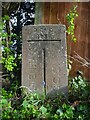
Boundary Stone, Battledown, Cheltenham
On the Northern verge of Battledown Approach opposite Battledown Drive. The boundary between Cheltenham and Gloucestershire County. Reinforced concrete.
Inscription: B. of C. / 1935. / Cheltenham / G. C. C.
Milestone Society National ID: GL_CMCK02pb
Image: © Mr Red
Taken: 1 Apr 2022
0.15 miles
8
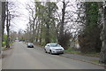
Battledown Approach
This is the lower (western) end of the street which runs east from hale's rd and then splits into Oakley Rd, Birchley Rd and Stanley Rd running up the hill onto Battledown.
Image: © Nigel Mykura
Taken: 10 Dec 2015
0.20 miles
9
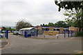
Holy Apostles Church of England Primary School
Image: © Terry Jacombs
Taken: 29 May 2012
0.21 miles
10
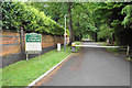
Barrier on Oakley Road
One entrance to the Battledown Estate, in which the roads are all private. See http://battledown.co.uk/history.asp
Image: © Bill Boaden
Taken: 25 May 2018
0.23 miles