
IMAGES TAKEN NEAR TO
Studland Drive, CHELTENHAM, GL52 5BU
Introduction
This page details the photographs taken nearby to Studland Drive, GL52 5BU by members of the Geograph project.
The Geograph project started in 2005 with the aim of publishing, organising and preserving representative images for every square kilometre of Great Britain, Ireland and the Isle of Man.

There are currently over 7.5m images from over14,400 individuals and you can help contribute to the project by visiting https://www.geograph.org.uk
Image Map
Images are licensed for reuse under creativecommons.org/licenses/by-sa/2.0
Notes
- Clicking on the map will re-center to the selected point.
- The higher the marker number, the further away the image location is from the centre of the postcode.
Image Listing (47 Images Found)
Images are licensed for reuse under creativecommons.org/licenses/by-sa/2.0
Image
Details
Distance
1
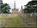
Cheltenham Cemetery Chapel and Crematorium
Sited on the North Eastern edge of Cheltenham under the lee of the Cotswold escarpment, the majority of burials and cremations in Cheltenham now take place here.
Image: © Terry Jacombs
Taken: 11 Aug 2005
0.15 miles
2
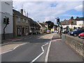
Prestbury High Street
A popular residential village on the northern edge of Cheltenham, the High street is on the main road to Winchcombe and Broadway. It boasts a general store, newsagent/post office, bank, public house/restaurant and a ladies hat shop..
Image: © Terry Jacombs
Taken: 11 Aug 2005
0.15 miles
3
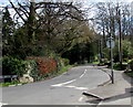
Western end of Noverton Lane, Prestbury
Looking east along Noverton Lane from the B4632 High Street.
Image: © Jaggery
Taken: 17 Mar 2019
0.20 miles
4
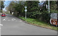
B4632 Southam Road distances sign, Prestbury
The sign on the corner of Noverton Lane shows
Southam 1¼ (miles), Cleeve Hill 2, Winchcombe 5, Stratford (-upon-Avon) 28.
Image: © Jaggery
Taken: 17 Mar 2019
0.20 miles
7
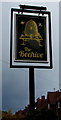
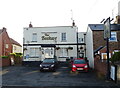
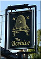
Beehive pub name sign, Prestbury
On the post on the right here. https://www.geograph.org.uk/photo/6089636
Image: © Jaggery
Taken: 17 Mar 2019
0.21 miles
8
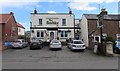
The Beehive, Prestbury
Pub at 33 Bouncers Lane Prestbury. https://www.geograph.org.uk/photo/6089640 to the name sign on the post on the right.
Image: © Jaggery
Taken: 17 Mar 2019
0.21 miles
9
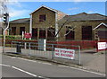
NO STOPPING - NO EXCUSES banner in Prestbury
On Bouncers Lane railings outside Prestbury St Mary's C of E Junior School.
Image: © Jaggery
Taken: 17 Mar 2019
0.21 miles
10
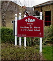
Welcome to Prestbury St Mary's C of E Junior School
The name sign is located here. https://www.geograph.org.uk/photo/6090466
Image: © Jaggery
Taken: 17 Mar 2019
0.21 miles