
IMAGES TAKEN NEAR TO
Mill Lane, CHELTENHAM, GL52 3NE
Introduction
This page details the photographs taken nearby to Mill Lane, GL52 3NE by members of the Geograph project.
The Geograph project started in 2005 with the aim of publishing, organising and preserving representative images for every square kilometre of Great Britain, Ireland and the Isle of Man.

There are currently over 7.5m images from over14,400 individuals and you can help contribute to the project by visiting https://www.geograph.org.uk
Image Map
Images are licensed for reuse under creativecommons.org/licenses/by-sa/2.0
Notes
- Clicking on the map will re-center to the selected point.
- The higher the marker number, the further away the image location is from the centre of the postcode.
Image Listing (72 Images Found)
Images are licensed for reuse under creativecommons.org/licenses/by-sa/2.0
Image
Details
Distance
1
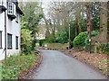
Mill Lane jogger
A run uphill on a winter's morning gets the blood flowing!
Image: © Jonathan Billinger
Taken: 12 Dec 2014
0.04 miles
2
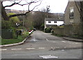
East along Mill Lane, Prestbury
Viewed across the B4632 from the corner of Mill Street.
A dark green telecoms cabinet is on the left.
Image: © Jaggery
Taken: 17 Mar 2019
0.05 miles
3
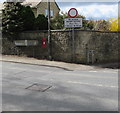
Corner of Mill Street and Southam Road, Prestbury
The B4632 directions sign alongside Southam Road shows the way to Cheltenham and Stratford (-upon-Avon).
Image: © Jaggery
Taken: 17 Mar 2019
0.08 miles
4
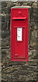
King George V postbox in a Southam Road wall, Prestbury
Located here. https://www.geograph.org.uk/photo/6090871 The GR on the box is short for Georgius Rex, Latin for King George, in this case King George V who reigned from May 1910-January 1936.
Image: © Jaggery
Taken: 17 Mar 2019
0.08 miles
5
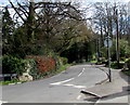
Western end of Noverton Lane, Prestbury
Looking east along Noverton Lane from the B4632 High Street.
Image: © Jaggery
Taken: 17 Mar 2019
0.08 miles
6
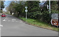
B4632 Southam Road distances sign, Prestbury
The sign on the corner of Noverton Lane shows
Southam 1¼ (miles), Cleeve Hill 2, Winchcombe 5, Stratford (-upon-Avon) 28.
Image: © Jaggery
Taken: 17 Mar 2019
0.09 miles
7
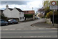
West along Mill Street, Prestbury
Viewed across the B4632 Southam Road. A sign shows No access except cyclists Mon - Fri 7.30am - 9.30am.
Image: © Jaggery
Taken: 17 Mar 2019
0.11 miles
8
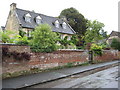
House in Prestbury
Cotswold stone built house in Prestbury.
Image: © Philip Halling
Taken: 21 Aug 2010
0.11 miles
9
![Prestbury houses [32]](https://s1.geograph.org.uk/geophotos/06/92/27/6922765_55e41c4f_120x120.jpg)
Prestbury houses [32]
Ivy Cottage in Mill Lane is a detached 17th century property. Timber framed, square-panelled with plastered noggin, set on a stone plinth. The gable ends are limestone and the roof is thatched. Listed, grade II, with details at: https://historicengland.org.uk/listing/the-list/list-entry/1091911
The village of Prestbury, occupied since Saxon times, is some 1½ miles northeast of the town of Cheltenham, which it once rivalled as a commercial centre. A market was established in 1249, but it declined and the historic village is now merely a suburb of the larger town. The village is home to Prestbury Park, the Cheltenham Racecourse. The village is reputed to be one of the most haunted places in Britain.
Image: © Michael Dibb
Taken: 20 May 2021
0.12 miles
10
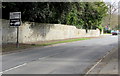
B4632 direction sign, High Street, Prestbury
The sign shows that the course of the B4632 turns through 90 degrees at the roundabout ahead.
Image: © Jaggery
Taken: 17 Mar 2019
0.12 miles