
IMAGES TAKEN NEAR TO
The Woodlands, STROUD, GL5 1QE
Introduction
This page details the photographs taken nearby to The Woodlands, GL5 1QE by members of the Geograph project.
The Geograph project started in 2005 with the aim of publishing, organising and preserving representative images for every square kilometre of Great Britain, Ireland and the Isle of Man.

There are currently over 7.5m images from over14,400 individuals and you can help contribute to the project by visiting https://www.geograph.org.uk
Image Map
Images are licensed for reuse under creativecommons.org/licenses/by-sa/2.0
Notes
- Clicking on the map will re-center to the selected point.
- The higher the marker number, the further away the image location is from the centre of the postcode.
Image Listing (25 Images Found)
Images are licensed for reuse under creativecommons.org/licenses/by-sa/2.0
Image
Details
Distance
1
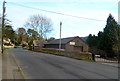
Gloucester Street Forge Ltd, Stroud
Despite its name, located at 140 Slad Road in The Old Forge.
The name sign shows that the firm's business is ornamental ironwork and steel fabrication.
Image: © Jaggery
Taken: 8 Jan 2012
0.10 miles
2
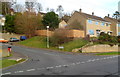
Corner of Slad Road and Peghouse Rise, Stroud
Viewed across Slad Road. The street name sign shows Peghouse Rise leading to Shepherds Croft.
Image: © Jaggery
Taken: 8 Jan 2012
0.13 miles
3
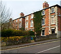
Corner of Slad Road and Sycamore Drive, Stroud
Sycamore Drive passes houses in Slad Road.
Image: © Jaggery
Taken: 8 Jan 2012
0.14 miles
4
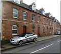
Slad Road houses, Stroud
The name Woodland Terrace is inscribed in stone above a doorway, but there was no modern street sign showing this name. The address of the houses is Slad Road.
Image: © Jaggery
Taken: 8 Jan 2012
0.14 miles
5
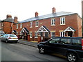
Recently-built housing, Slad Road, Stroud
The year 2010 in inscribed on the wall.
Image: © Jaggery
Taken: 8 Jan 2012
0.15 miles
6
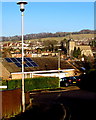
View from Belle Vue Road, Stroud
The church is All Saints. http://www.geograph.org.uk/photo/3305064
Image: © Jaggery
Taken: 28 Dec 2014
0.17 miles
7
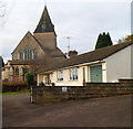
East side of All Saints Church, Stroud
Viewed from Sycamore Drive.
Image: © Jaggery
Taken: 8 Jan 2012
0.17 miles
8
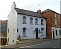
A white and blue house, Slad Road, Stroud
The house is near the junction with Springfield Road and Lansdown, close to The Fountain Inn. http://www.geograph.org.uk/photo/3304511
Image: © Jaggery
Taken: 8 Jan 2012
0.18 miles
9
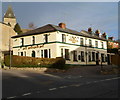
The Fountain Inn, Stroud
Pub on the corner of Springfield Road and Slad Road.
Image: © Jaggery
Taken: 8 Jan 2012
0.19 miles
10
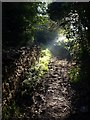
Path past Dyersmead
This path climbs the southern slopes of the Slad valley from the New Mills Trading Estate to Summer Street. Here it approaches the edge of the square, with a limestone wall on the left.
Image: © Derek Harper
Taken: 19 Oct 2007
0.19 miles