
IMAGES TAKEN NEAR TO
Lansdown, STROUD, GL5 1BN
Introduction
This page details the photographs taken nearby to Lansdown, GL5 1BN by members of the Geograph project.
The Geograph project started in 2005 with the aim of publishing, organising and preserving representative images for every square kilometre of Great Britain, Ireland and the Isle of Man.

There are currently over 7.5m images from over14,400 individuals and you can help contribute to the project by visiting https://www.geograph.org.uk
Image Map
Images are licensed for reuse under creativecommons.org/licenses/by-sa/2.0
Notes
- Clicking on the map will re-center to the selected point.
- The higher the marker number, the further away the image location is from the centre of the postcode.
Image Listing (668 Images Found)
Images are licensed for reuse under creativecommons.org/licenses/by-sa/2.0
Image
Details
Distance
1
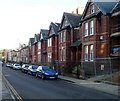
Lansdown houses, Stroud
Houses on the south side of a street named Lansdown, viewed from the Locking Hill end.
The temporary fencing on the right is at the perimeter of a site where houses are being built.
Image: © Jaggery
Taken: 8 Jan 2012
0.02 miles
2
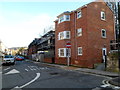
House construction, Lansdown, Stroud
Viewed from the corner of Locking Hill. Houses are being built in a fenced-off area of scaffolding
on the right, on the site formerly occupied by small car park.
Image: © Jaggery
Taken: 8 Jan 2012
0.02 miles
3
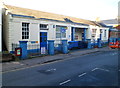
RSPCA, Lansdown, Stroud
RSPCA South Cotswold branch, located in the Rosewell Clinic, 30 Lansdown, Stroud.
Image: © Jaggery
Taken: 8 Jan 2012
0.03 miles
4
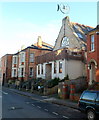
Distinctive house and wall attachment, Lansdown, Stroud
Viewed across Lansdown, a street on the south side of Slad Brook
aligned roughly parallel with Slad Road on the north side of the brook.
Image: © Jaggery
Taken: 8 Jan 2012
0.04 miles
5
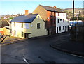
SW end of Brickrow, Stroud
Viewed from Ryeleaze Road looking towards Brickrow. According to one online source,
this is the only street named Brickrow in the UK, though there are several named Brick Row.
Image: © Jaggery
Taken: 28 Dec 2014
0.04 miles
6
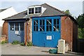
Stroud Old Fire Station
Stroud Old Fire Station, Lansdown, Stroud, appears still to be owned by Gloucestershire County Council. It was replaced by Image
Image: © Kevin Hale
Taken: 3 Jun 2007
0.04 miles
8
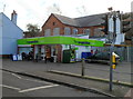
The Co-operative Food store, Slad Road, Stroud
Located at 16 Slad Road, opposite Park Gardens.
Image: © Jaggery
Taken: 8 Jan 2012
0.05 miles
9

The ornate elevation of Stroud School of Science and Art
Image: © Steve Fareham
Taken: 9 Dec 2008
0.05 miles
10
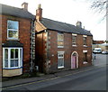
Havelock Cottages, Stroud
An inscription in stone in the wall of the house on the right shows HAVELOCK COTTAGES, though that name is no longer in use. A Stroud directory of the 1890s records a number 1 and a number 2 Havelock Cottages, perhaps the two houses seen here. Another possibility is that the other cottage used to be on the right side, on the site now occupied by a Co-operative Food Store. http://www.geograph.org.uk/photo/3303823
Image: © Jaggery
Taken: 8 Jan 2012
0.05 miles