
IMAGES TAKEN NEAR TO
Lansdown, STROUD, GL5 1BH
Introduction
This page details the photographs taken nearby to Lansdown, GL5 1BH by members of the Geograph project.
The Geograph project started in 2005 with the aim of publishing, organising and preserving representative images for every square kilometre of Great Britain, Ireland and the Isle of Man.

There are currently over 7.5m images from over14,400 individuals and you can help contribute to the project by visiting https://www.geograph.org.uk
Image Map
Images are licensed for reuse under creativecommons.org/licenses/by-sa/2.0
Notes
- Clicking on the map will re-center to the selected point.
- The higher the marker number, the further away the image location is from the centre of the postcode.
Image Listing (495 Images Found)
Images are licensed for reuse under creativecommons.org/licenses/by-sa/2.0
Image
Details
Distance
1
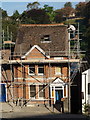
Roofing work
A house on Lansdown in Stroud gets some serious attention.
Image: © Derek Harper
Taken: 19 Oct 2007
0.01 miles
2
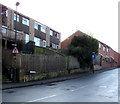
Brickrow, Stroud
The NE end of Brickrow, viewed from Lansdown.
Image: © Jaggery
Taken: 28 Dec 2014
0.02 miles
3
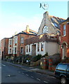
Distinctive house and wall attachment, Lansdown, Stroud
Viewed across Lansdown, a street on the south side of Slad Brook
aligned roughly parallel with Slad Road on the north side of the brook.
Image: © Jaggery
Taken: 8 Jan 2012
0.02 miles
4
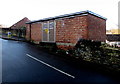
Lansdown electricity substation, Stroud
The Central Networks electricity substation is on the corner of Brickrow and Lansdown. Its identifier is LANSDOWN 9730. In addition to the standard DANGER OF DEATH - ELECTRICITY - KEEP OUT notice on the door, others warn of the presence of SF6 (sulphur hexafluoride, an insulating gas used in high voltage systems). A small LandKare Ltd notice states that this area has been sprayed with glyphosate/24D/flazasulfuron (a weedkiller).
Image: © Jaggery
Taken: 28 Dec 2014
0.02 miles
5
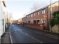
Row of brick houses in Brickrow, Stroud
Brickrow is a street extending from Ryeleaze Road (behind the camera) to Lansdown.
Image: © Jaggery
Taken: 28 Dec 2014
0.02 miles
6
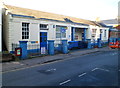
RSPCA, Lansdown, Stroud
RSPCA South Cotswold branch, located in the Rosewell Clinic, 30 Lansdown, Stroud.
Image: © Jaggery
Taken: 8 Jan 2012
0.03 miles
7
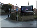
Junction of Lansdown and Brick Row, Stroud
Brick Row is on the left. A Clear Channel advertising billboard dominates the corner. A triangular warning sign shows humps for 240 yards.
Image: © Jaggery
Taken: 28 Dec 2014
0.03 miles
8
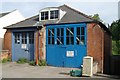
Stroud Old Fire Station
Stroud Old Fire Station, Lansdown, Stroud, appears still to be owned by Gloucestershire County Council. It was replaced by Image
Image: © Kevin Hale
Taken: 3 Jun 2007
0.03 miles
9
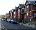
Lansdown houses, Stroud
Houses on the south side of a street named Lansdown, viewed from the Locking Hill end.
The temporary fencing on the right is at the perimeter of a site where houses are being built.
Image: © Jaggery
Taken: 8 Jan 2012
0.03 miles
10
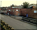
Stroud Instruments Ltd, Stroud
Located at 36-40 Slad Road, these are the premises of Stroud Instruments Ltd, manufacturers of instrumentation modules for process signal conditioning, monitoring, display and control.
On the right are the premises of Cottle Memorials, monumental masons.
Image: © Jaggery
Taken: 8 Jan 2012
0.05 miles