
IMAGES TAKEN NEAR TO
Monkscroft, CHELTENHAM, GL51 7TU
Introduction
This page details the photographs taken nearby to Monkscroft, GL51 7TU by members of the Geograph project.
The Geograph project started in 2005 with the aim of publishing, organising and preserving representative images for every square kilometre of Great Britain, Ireland and the Isle of Man.

There are currently over 7.5m images from over14,400 individuals and you can help contribute to the project by visiting https://www.geograph.org.uk
Image Map
Images are licensed for reuse under creativecommons.org/licenses/by-sa/2.0
Notes
- Clicking on the map will re-center to the selected point.
- The higher the marker number, the further away the image location is from the centre of the postcode.
Image Listing (52 Images Found)
Images are licensed for reuse under creativecommons.org/licenses/by-sa/2.0
Image
Details
Distance
2
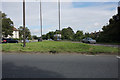
Gloucester Road, Cheltenham
The A40 heading for the centre of Cheltenham. It is viewed here from the roundabout on its junction with the A4013.
Image: © Bill Boaden
Taken: 16 Jul 2016
0.03 miles
4
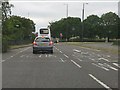
Dual carriageway begins on Gloucester Road
Image: © Peter Whatley
Taken: 21 May 2011
0.04 miles
5
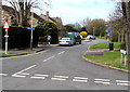
Miserden Road, Cheltenham
Viewed from Benhall Avenue. Miserden Road, parallel with the south side of the A40 Gloucester Road, is part of National Cycle Network Route 41, here towards Gloucester. The Sustrans website in early July 2016 states that National Cycle Network Route 41 is a long distance route that when complete will connect Bristol, Gloucester, Stratford-upon-Avon and Rugby. A warning sign depicting a bicycle is on the left.
Image: © Jaggery
Taken: 3 Apr 2016
0.05 miles
6
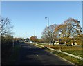
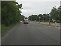
A40 (Gloucester Road), Cheltenham
Dual carriageway on the main road between Cheltenham and Gloucester
Image: © David Smith
Taken: 25 Nov 2016
0.08 miles
7
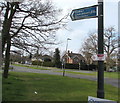
Cycle route direction sign on a Cheltenham corner
On the corner of Gloucester Road, the sign points towards Benhall Avenue and a cycle route to Benhall, Churchdown, Gloucester. A smaller sign points towards this http://www.geograph.org.uk/photo/4893121 convenience store in Benhall Avenue.
Image: © Jaggery
Taken: 3 Apr 2016
0.08 miles
8
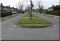
Keep Left sign, Benhall Avenue, Cheltenham
At the northern end of Benhall Avenue, near the A40 Gloucester Road junction.
Image: © Jaggery
Taken: 3 Apr 2016
0.08 miles
9
Roundabout on Gloucester Road, Cheltenham
Image: © David Howard
Taken: 17 Sep 2017
0.09 miles
10
Housing estate off Gloucester Road
Gloucester Road is the A40. These houses serve the GCHQ which is close by.
Image: © Clint Mann
Taken: 1 Apr 2016
0.09 miles