
IMAGES TAKEN NEAR TO
Libertus Road, CHELTENHAM, GL51 7EL
Introduction
This page details the photographs taken nearby to Libertus Road, GL51 7EL by members of the Geograph project.
The Geograph project started in 2005 with the aim of publishing, organising and preserving representative images for every square kilometre of Great Britain, Ireland and the Isle of Man.

There are currently over 7.5m images from over14,400 individuals and you can help contribute to the project by visiting https://www.geograph.org.uk
Image Map
Images are licensed for reuse under creativecommons.org/licenses/by-sa/2.0
Notes
- Clicking on the map will re-center to the selected point.
- The higher the marker number, the further away the image location is from the centre of the postcode.
Image Listing (251 Images Found)
Images are licensed for reuse under creativecommons.org/licenses/by-sa/2.0
Image
Details
Distance
1
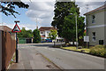
Griffiths Avenue, Cheltenham
Looking towards the junction with Libertus Road in the St Mark's district of Cheltenham. The building on the right is a care home for the elderly - of which there seem to be a large number in this area.
Image: © Stephen McKay
Taken: 25 Jul 2015
0.02 miles
2
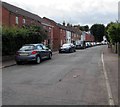
Southwest end of Rowanfield Road, Cheltenham
Towards Libertus Road from near the corner of Roman Road.
Image: © Jaggery
Taken: 3 Aug 2016
0.06 miles
3
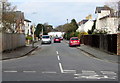
Fairmount Road, Cheltenham
Vieewed across Gloucester Road. Fairmount Road extends to Church Road, about 170 metres ahead.
Image: © Jaggery
Taken: 3 Apr 2016
0.07 miles
4
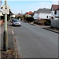
Neighbourhood Watch notice on a Church Road lamppost, Cheltenham
The notice states We immediately report SUSPICIOUS PERSONS to the POLICE.
Image: © Jaggery
Taken: 3 Apr 2016
0.07 miles
5
Libertus Road, Cheltenham
Residential road on the western side of Cheltenham
Image: © Chris Heaton
Taken: 31 Jul 2023
0.08 miles
6
Contrasting houses, Church Road, Cheltenham
Large white houses and a small bungalow.
Image: © Jaggery
Taken: 3 Apr 2016
0.09 miles
7
Pastel colours in Roman Road, Cheltenham
Roman Road houses near the corner of Rowanfield Road.
Image: © Jaggery
Taken: 3 Aug 2016
0.09 miles
8
Tree and house on a Cheltenham corner
On the corner of Fairmount Road (left) and Church Road.
Image: © Jaggery
Taken: 3 Apr 2016
0.09 miles
9
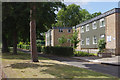
Griffiths Avenue, Cheltenham
Goldfoot house is located on Griffiths Avenue in the leafy St Mark's district of Cheltenham. The building dates from 1976 and comprises 34 sheltered accommodation flats.
Image: © Stephen McKay
Taken: 25 Jul 2015
0.10 miles
10
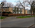
Goldfoot House, Cheltenham
Viewed across Griffiths Avenue. This is the southwest part of a group of interconnected buildings named Goldfoot House, retirement/sheltered housing built in 1976. In 2016, Goldfoot House is managed by Cheltenham Borough Homes.
Image: © Jaggery
Taken: 3 Apr 2016
0.10 miles