
IMAGES TAKEN NEAR TO
Libertus Road, CHELTENHAM, GL51 7EH
Introduction
This page details the photographs taken nearby to Libertus Road, GL51 7EH by members of the Geograph project.
The Geograph project started in 2005 with the aim of publishing, organising and preserving representative images for every square kilometre of Great Britain, Ireland and the Isle of Man.

There are currently over 7.5m images from over14,400 individuals and you can help contribute to the project by visiting https://www.geograph.org.uk
Image Map
Images are licensed for reuse under creativecommons.org/licenses/by-sa/2.0
Notes
- Clicking on the map will re-center to the selected point.
- The higher the marker number, the further away the image location is from the centre of the postcode.
Image Listing (284 Images Found)
Images are licensed for reuse under creativecommons.org/licenses/by-sa/2.0
Image
Details
Distance
1
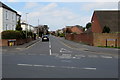
Libertus Road, Cheltenham
Viewed across Gloucester Road.
Image: © Jaggery
Taken: 3 Apr 2016
0.05 miles
2
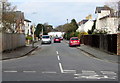
Fairmount Road, Cheltenham
Vieewed across Gloucester Road. Fairmount Road extends to Church Road, about 170 metres ahead.
Image: © Jaggery
Taken: 3 Apr 2016
0.07 miles
3
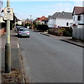
Neighbourhood Watch notice on a Church Road lamppost, Cheltenham
The notice states We immediately report SUSPICIOUS PERSONS to the POLICE.
Image: © Jaggery
Taken: 3 Apr 2016
0.07 miles
4
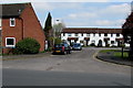
Libertus Court, Cheltenham
Cul-de-sac on the NE side of Libertus Road.
Image: © Jaggery
Taken: 3 Apr 2016
0.07 miles
5
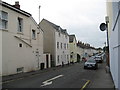
Roman Road IV - Cheltenham, Gloucestershire
In 1850 the Cheltenham and Gloucester Freehold Land Society bought 15 acres in this area fronting the Gloucester Road for housing. Originally called the Libertus Estate, the object was to acquire for members enough freehold land to enable them to vote. After St Mark's Church was built the name fell from view and the only reminder now is the nearby Libertus Road. This road connects to the Garden Suburb – in 1919 Cheltenham Town Council bought 115 acres from Mr H Unwin, owner of Arle Court, for housing where all the roads are named after poets. Information regarding the Libertus Estate and Garden Suburb from the website http://web.archive.org/web/20120406164246/http://www.cheltenham4u.co.uk/index.asp and thanks are due to them for this. Time taken 3.20 pm BST (British Summer Time).
Image: © Martin Richard Phelan
Taken: 25 Sep 2014
0.08 miles
6
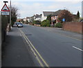
Warning sign - humps for half a mile, Libertus Road, Cheltenham
The sign faces Libertus Road between the Gloucester Road junction behind the camera and the right turn into Libertus Court http://www.geograph.org.uk/photo/4894515 ahead.
Image: © Jaggery
Taken: 3 Apr 2016
0.08 miles
7
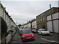
Roman Road II - Cheltenham, Gloucestershire
In 1850 the Cheltenham and Gloucester Freehold Land Society bought 15 acres in this area fronting the Gloucester Road for housing. Originally called the Libertus Estate, the object was to acquire for members enough freehold land to enable them to vote. After St Mark's Church was built the name fell from view and the only reminder now is the nearby Libertus Road. This road connects to the Garden Suburb – in 1919 Cheltenham Town Council bought 115 acres from Mr H Unwin, owner of Arle Court, for housing where all the roads are named after poets. Information regarding the Libertus Estate and Garden Suburb from the website http://web.archive.org/web/20120406164246/http://www.cheltenham4u.co.uk/index.asp and thanks are due to them for this. Time taken 3.17 pm BST (British Summer Time).
Image: © Martin Richard Phelan
Taken: 25 Sep 2014
0.08 miles
8
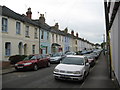
Roman Road III - Cheltenham, Gloucestershire
In 1850 the Cheltenham and Gloucester Freehold Land Society bought 15 acres in this area fronting the Gloucester Road for housing. Originally called the Libertus Estate, the object was to acquire for members enough freehold land to enable them to vote. After St Mark's Church was built the name fell from view and the only reminder now is the nearby Libertus Road. This road connects to the Garden Suburb – in 1919 Cheltenham Town Council bought 115 acres from Mr H Unwin, owner of Arle Court, for housing where all the roads are named after poets. Information regarding the Libertus Estate and Garden Suburb from the website http://web.archive.org/web/20120406164246/http://www.cheltenham4u.co.uk/index.asp and thanks are due to them for this. Time taken 3.18 pm BST (British Summer Time).
Image: © Martin Richard Phelan
Taken: 25 Sep 2014
0.08 miles
9
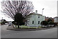
Tree and house on a Cheltenham corner
On the corner of Fairmount Road (left) and Church Road.
Image: © Jaggery
Taken: 3 Apr 2016
0.08 miles
10
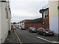
Roman Road I - Cheltenham, Gloucestershire
In 1850 the Cheltenham and Gloucester Freehold Land Society bought 15 acres in this area fronting the Gloucester Road for housing. Originally called the Libertus Estate, the object was to acquire for members enough freehold land to enable them to vote. After St Mark's Church was built the name fell from view and the only reminder now is the nearby Libertus Road. This road connects to the Garden Suburb – in 1919 Cheltenham Town Council bought 115 acres from Mr H Unwin, owner of Arle Court, for housing where all the roads are named after poets. In 1985 Roman Road was the scene of a vicious murder and sadly to date the person or persons responsible have still not been caught. Information regarding the Libertus Estate and Garden Suburb from the website http://web.archive.org/web/20120406164246/http://www.cheltenham4u.co.uk/index.asp and thanks are due to them for this. Time taken 3.16 pm BST (British Summer Time).
Image: © Martin Richard Phelan
Taken: 25 Sep 2014
0.08 miles