
IMAGES TAKEN NEAR TO
Camellia Court, CHELTENHAM, GL51 3EJ
Introduction
This page details the photographs taken nearby to Camellia Court, GL51 3EJ by members of the Geograph project.
The Geograph project started in 2005 with the aim of publishing, organising and preserving representative images for every square kilometre of Great Britain, Ireland and the Isle of Man.

There are currently over 7.5m images from over14,400 individuals and you can help contribute to the project by visiting https://www.geograph.org.uk
Image Map
Images are licensed for reuse under creativecommons.org/licenses/by-sa/2.0
Notes
- Clicking on the map will re-center to the selected point.
- The higher the marker number, the further away the image location is from the centre of the postcode.
Image Listing (19 Images Found)
Images are licensed for reuse under creativecommons.org/licenses/by-sa/2.0
Image
Details
Distance
1
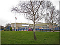
Warden Hill Primary School
Located in Durham Close, this is a significantly larger than average primary school with nearly 400 pupils on roll.
Image: © Richard Dorrell
Taken: 3 Mar 2013
0.12 miles
2
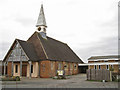
St Christopher's Church, Walden Hill
Located in Lincoln Avenue, St Christopher's Church of England church is linked with the nearby United Reformed Church (see Image]).
St Christopher's is proud of its set of ten stained glass windows designed and executed by Thomas Denny DA (Edin), each based upon a parable from the Gospels. The windows are also linked by colour, with the colours from each window carrying over into adjacent ones.
Image: © Richard Dorrell
Taken: 3 Mar 2013
0.13 miles
3
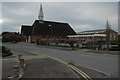
Church of St Christopher, Warden Hill
The Church of St Christopher on Salisbury Avenue, Warden Hill.
Image: © Philip Halling
Taken: 29 Jan 2011
0.13 miles
4
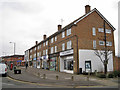
Warden Hill shops
Located in Salisbury Avenue, and viewed here from the corner of Lincoln Avenue.
Image: © Richard Dorrell
Taken: 3 Mar 2013
0.14 miles
5
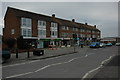
Shops on Salisbury Avenue
Shops on Salisbury Avenue in Warden Hill.
Image: © Philip Halling
Taken: 29 Jan 2011
0.15 miles
6
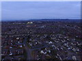
Up Hatherley
Taken from playing fields using DJI Phantom 3
Image: © andy dolman
Taken: 20 Mar 2016
0.15 miles
7
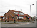
The Double Barrel public house
Located in Salisbury Avenue, Warden Hill on the junction with Oxford Way. The pub serves a large residential area which was originally developed in the 1950s, but further development took place in the 60s and 80s.
Image: © Richard Dorrell
Taken: 3 Mar 2013
0.16 miles
8
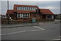
Double Barrel
The Double Barrel pub on Salisbury Avenue in Warden Hill.
Image: © Philip Halling
Taken: 29 Jan 2011
0.18 miles
9
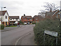
Davallia Drive, Up Hatherley
An established but modern cul-de-sac of detached housing in this south western suburb of Cheltenham.
Image: © Richard Dorrell
Taken: 3 Mar 2013
0.19 miles
10
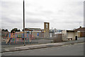
Warden Hill United Reformed Church
Located in Salisbury Avenue and built in the 1950s. On 16 January 2010 Warden Hill United Reformed Church and St Christopher's Church, Warden Hill (see Image] ) entered into a Local Ecumenical Partnership. All services are now united and the venues alternate on a weekly basis between the two buildings.
Image: © Richard Dorrell
Taken: 3 Mar 2013
0.19 miles