
IMAGES TAKEN NEAR TO
Culross Close, CHELTENHAM, GL50 4NF
Introduction
This page details the photographs taken nearby to Culross Close, GL50 4NF by members of the Geograph project.
The Geograph project started in 2005 with the aim of publishing, organising and preserving representative images for every square kilometre of Great Britain, Ireland and the Isle of Man.

There are currently over 7.5m images from over14,400 individuals and you can help contribute to the project by visiting https://www.geograph.org.uk
Image Map
Images are licensed for reuse under creativecommons.org/licenses/by-sa/2.0
Notes
- Clicking on the map will re-center to the selected point.
- The higher the marker number, the further away the image location is from the centre of the postcode.
Image Listing (148 Images Found)
Images are licensed for reuse under creativecommons.org/licenses/by-sa/2.0
Image
Details
Distance
1
![Cheltenham houses [131]](https://s0.geograph.org.uk/geophotos/06/91/72/6917252_e5eea079_120x120.jpg)
Cheltenham houses [131]
In Evesham Road, almost hidden at the bottom of the long driveway is The Grange, a large villa built in the 1830s, now four dwellings. Constructed of stuccoed brick with some fine detailing under a concealed roof. There is another view of the property at Image Listed, grade II, with details at: https://historicengland.org.uk/listing/the-list/list-entry/1333232
Cheltenham is located at the foot of the Cotswold scarp with the small River Chelt flowing through the town. After the discovery of mineral springs in 1716 Cheltenham became a spa town and many Regency houses and other buildings were erected. The town is home to the renowned Cheltenham Festival, four days of horse jump racing culminating in the Gold Cup, held annually in March at the nearby racecourse.
Image: © Michael Dibb
Taken: 19 May 2021
0.05 miles
2
![Cheltenham houses [132]](https://s1.geograph.org.uk/geophotos/06/91/72/6917253_4b1d132f_120x120.jpg)
Cheltenham houses [132]
In Evesham Road, almost hidden at the bottom of the long driveway is The Grange, a large villa built in the 1830s, now four dwellings. Constructed of stuccoed brick with some fine detailing under a concealed roof. There is another view of the property at Image Listed, grade II, with details at: https://historicengland.org.uk/listing/the-list/list-entry/1333232
Cheltenham is located at the foot of the Cotswold scarp with the small River Chelt flowing through the town. After the discovery of mineral springs in 1716 Cheltenham became a spa town and many Regency houses and other buildings were erected. The town is home to the renowned Cheltenham Festival, four days of horse jump racing culminating in the Gold Cup, held annually in March at the nearby racecourse.
Image: © Michael Dibb
Taken: 19 May 2021
0.05 miles
3
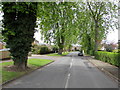
West along Cleevelands Drive, Cheltenham
From Evesham Road.
Image: © Jaggery
Taken: 27 Apr 2016
0.06 miles
4
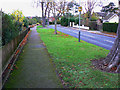
Cleevelands Drive, Cheltenham
Cleevelands Drive is a pleasant suburban road developed possibly in the years shortly before or after the second world war. The road connecting with the drive at the left is Huntsfield Close, a short cul-de-sac.
Image: © Brian Robert Marshall
Taken: 5 Nov 2009
0.06 miles
5
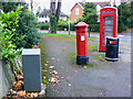
Penfold pillar box, K6 telephone box, a litter bin and a grey box, Evesham Road, Cheltenham
As fine a collection of old and new street furniture in one place as one will see anywhere. The neatly-designed grey drop-box, used by post-persons as temporary storage, is modern but can hold its head up with its more venerable neighbours even though it's unlikely it will ever receive the attention of English Heritage http://www.imagesofengland.org.uk/details/default.aspx?id=474611 Normally drop-boxes are attached to their accompanying workaday post-Victorian postboxes but it is doubtful that such a fate would be visited on the Empress of India's iconography.
Image: © Brian Robert Marshall
Taken: 5 Nov 2009
0.08 miles
6
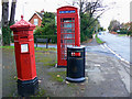
Penfold pillar box, K6 telephone box and a litter bin, Evesham Road, Cheltenham
The Victorian postbox leans a little to the left. So does the phone box. The litter bin seems to be straight. Evesham Road leads away to the north. The road entering from the left is Cleevelands Drive. The postbox can be seen in more detail here Image
Image: © Brian Robert Marshall
Taken: 5 Nov 2009
0.08 miles
7
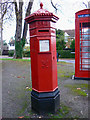
Penfold pillar box, Evesham Road, Cheltenham
This provides a closer view of the Victorian postbox seen here Image As with all Penfolds it is listed http://www.imagesofengland.org.uk/details/default.aspx?id=474611 In the background is Cleevelands Drive.
Image: © Brian Robert Marshall
Taken: 5 Nov 2009
0.08 miles
8
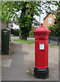
Victorian pillarbox on a Cheltenham corner
Facing Evesham Road on the corner of Cleevelands Drive, this is a Penfold
Victorian pillar box of the type which were installed from 1866-1879.
Grade II listed in 1977. A Grade II listed K6 phonebox http://www.geograph.org.uk/photo/5145448 is nearby.
Image: © Jaggery
Taken: 27 Apr 2016
0.08 miles
9
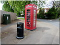
K6 phonebox on a Cheltenham corner
On the corner of Evesham Road and Cleevelands Drive, this is a K6 phonebox designed by Sir Giles Gilbert Scott in 1935. Grade II listed in 1998. A Grade II listed Victorian pillarbox is nearby. http://www.geograph.org.uk/photo/5145446
Image: © Jaggery
Taken: 27 Apr 2016
0.08 miles
10
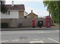
Older and newer communications equipment on a Cheltenham corner
On the Evesham Road side of the corner of Cleevelands Drive are two modern dark green telecoms cabinets, a red Victorian pillarbox http://www.geograph.org.uk/photo/5145446 and a red K6 phonebox http://www.geograph.org.uk/photo/5145448 designed in 1935.
Both the pillarbox and phonebox are Grade II listed.
Image: © Jaggery
Taken: 27 Apr 2016
0.08 miles