
IMAGES TAKEN NEAR TO
Oxstalls Lane, GLOUCESTER, GL2 9HW
Introduction
This page details the photographs taken nearby to Oxstalls Lane, GL2 9HW by members of the Geograph project.
The Geograph project started in 2005 with the aim of publishing, organising and preserving representative images for every square kilometre of Great Britain, Ireland and the Isle of Man.

There are currently over 7.5m images from over14,400 individuals and you can help contribute to the project by visiting https://www.geograph.org.uk
Image Map
Images are licensed for reuse under creativecommons.org/licenses/by-sa/2.0
Notes
- Clicking on the map will re-center to the selected point.
- The higher the marker number, the further away the image location is from the centre of the postcode.
Image Listing (15 Images Found)
Images are licensed for reuse under creativecommons.org/licenses/by-sa/2.0
Image
Details
Distance
1
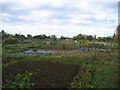
Allotments behind Estcourt Road
These allotments are on the floodplain of Wootton Brook between Estcourt Road and Oxstalls.
Image: © David Stowell
Taken: 13 Nov 2005
0.09 miles
2
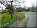
Junction at Longlevens
Junction (at roundabout) of Estcourt Road and Cheltenham Road.
Image: © Clint Mann
Taken: 1 Apr 2016
0.13 miles
3
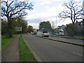
Estcourt Road, Gloucester
This road originally formed a northern bypass for Gloucester but as the city has grown a newer bypass has been built further out. At the time the picture was taken one carriageway was closed for the resurfacing work seen in the distance.
Image: © David Stowell
Taken: 13 Nov 2005
0.13 miles
4
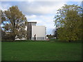
Oxstalls Campus, Gloucester University
This was developed as an academic site in the 1960s as a college of food and domestic science - know locally as the college of grub and scrub!
Image: © David Stowell
Taken: 13 Nov 2005
0.13 miles
5
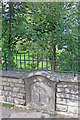
City meets County
This boundary stone dated 1902 is on a bridge over a small stream near the university.
Image: © Des Blenkinsopp
Taken: 29 Aug 2015
0.13 miles
6
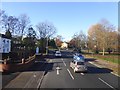
Approaching Cole Bridge on Cheltenham Road
On the right are the grounds of the university
Image: © David Smith
Taken: 25 Nov 2016
0.14 miles
7

B4063 Cheltenham Road westwards approaching Oxstalls Road junction
Image: © Roy Hughes
Taken: 2 Jun 2022
0.15 miles
8

B4063 Cheltenham Road westwards approaching A38 Island
Image: © Roy Hughes
Taken: 2 Jun 2022
0.15 miles
9
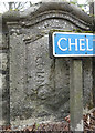
Old Boundary Marker
Municipal Boundary Marker on the southeast side of Cole Bridge, Wotton Brook on B4063 Cheltenham Road, Gloucester. Inscribed COUNTY to the left and CITY to the right, both vertical and separated by a vertical groove, with 1902 at the top. This marks the Gloucester City boundary.
Milestone Society National ID: GL_GLOU02bpb
Image: © Mr Red
Taken: 3 Apr 2019
0.15 miles
10
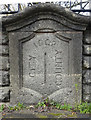
Old Boundary Marker
Municipal Boundary Marker on the northwest side of Cole Bridge, Wotton Brook on B4063 Cheltenham Road, Gloucester. Inscribed CITY to the left and COUNTY to the right, both vertical and separated by a vertical groove, with 1902 at the top. This marks the Gloucester City boundary. See also https://www.geograph.org.uk/photo/4698073
Milestone Society National ID: GL_GLOU02apb
Image: © Mr Red
Taken: 3 Apr 2019
0.15 miles