IMAGES TAKEN NEAR TO
Furzecroft, GLOUCESTER, GL2 4YZ
Introduction
This page details the photographs taken nearby to Furzecroft, GL2 4YZ by members of the Geograph project.
The Geograph project started in 2005 with the aim of publishing, organising and preserving representative images for every square kilometre of Great Britain, Ireland and the Isle of Man.

There are currently over 7.5m images from over14,400 individuals and you can help contribute to the project by visiting https://www.geograph.org.uk
Image Map
Images are licensed for reuse under creativecommons.org/licenses/by-sa/2.0
Notes
- Clicking on the map will re-center to the selected point.
- The higher the marker number, the further away the image location is from the centre of the postcode.
Image Listing (45 Images Found)
Images are licensed for reuse under creativecommons.org/licenses/by-sa/2.0
Image
Details
Distance
1

Naas Lane Roundabout directions sign, Quedgeley
Facing southbound traffic on the B4008 Bristol Road.
Image: © Jaggery
Taken: 22 Jan 2017
0.11 miles
2

Naas Lane direction signs, Quedgeley
At the western end of Naas Lane, facing the B4008 Bristol Road.
Left along Naas Lane for Brookthorpe Harescombe Business parks and Park and Ride.
Image: © Jaggery
Taken: 22 Jan 2017
0.11 miles
3
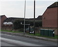
Three telecoms cabinets, Bristol Road, Quedgeley
On the west side of the B4008 Bristol Road near Mansfield Mews.
Image: © Jaggery
Taken: 22 Jan 2017
0.13 miles
4
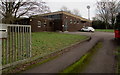
Hardwicke Telephone Exchange, Gloucestershire
Set back from the east side of the B4008 Bristol Road in the south of Quedgeley,
near the northern edge of Hardwicke. The Exchange identifier is SSHWK.
Image: © Jaggery
Taken: 22 Jan 2017
0.13 miles
5
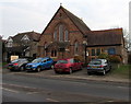
Quedgeley Methodist Church
Viewed across the B4008 Bristol Road. Quedgeley Methodist Church is part of the Gloucestershire Circuit of the Methodist Church. The church is at the southern edge of Quedgeley, near the Hardwicke boundary.
Image: © Jaggery
Taken: 22 Jan 2017
0.14 miles
6
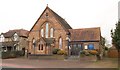
Quedgeley Methodist Church
The church faces Bristol Road. The blue panel states "established 1885".
Image: © Derek Harper
Taken: 12 Mar 2010
0.14 miles
7
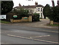
The Lawns Care Centre, Quedgeley
Set back from the west side of the B4008 Bristol Road.
Image: © Jaggery
Taken: 22 Jan 2017
0.14 miles
9
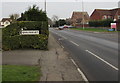
Quedgeley boundary sign in a hedge
Alongside the B4008 Bristol Road at the southern edge of Quedgeley, a suburb of the city of Gloucester.
The sign faces the northern edge of the village of Hardwicke in Stroud District, Gloucestershire.
The distant parked cars are at the edge of Quedgeley Methodist Church. http://www.geograph.org.uk/photo/5260612
Image: © Jaggery
Taken: 22 Jan 2017
0.15 miles