1
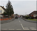
Watermeadows Quedgeley
Watermeadows is the Street name, the stream forms the district boundary with Hardwick in Stroud District to the left and Quedgeley in Gloucester to the right. This bit of Harwick can only be approached through Gloucester.
Image: © Peter Watkins
Taken: 3 Feb 2006
0.07 miles
2
Springfield, Hardwicke
Springfield is a cul-de-sac extending for 300 metres from Elmgrove Road East. A red phonebox is on the right.
Image: © Jaggery
Taken: 22 Jan 2017
0.13 miles
3
Hildyard Close, Hardwicke
Cul-de-sac viewed from Elmgrove Road East.
Image: © Jaggery
Taken: 22 Jan 2017
0.13 miles
4
Little Monsters Childcare, Hardwicke
Little Monsters Childcare is at 38 Elmgrove Road East, viewed in January 2017.
An October 2012 Google Earth Street View shows a Nisa Local convenience store (with a post office inside)
on this site. The village post office is now in this http://www.geograph.org.uk/photo/5261114 nearby One Stop convenience store.
Image: © Jaggery
Taken: 22 Jan 2017
0.15 miles
5
Row of bungalows, Elmgrove Road East, Hardwicke
Originally, bungalow was used in English for a lightly-built house, with a veranda and one storey.
In current UK usage it is a convenient word for any one-storey dwelling.
Image: © Jaggery
Taken: 22 Jan 2017
0.15 miles
6
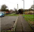
Trees near a Hardwicke footpath
Viewed from this http://www.geograph.org.uk/photo/5299589 path from Elmgrove Road East to Ashgrove Close.
Image: © Jaggery
Taken: 22 Jan 2017
0.16 miles
7
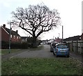
Dominant tree, Elmgrove Road East, Hardwicke
Much older than the nearby houses, a tree dominates this late
January 2017 view of the northwest end of Elmgrove Road East.
Image: © Jaggery
Taken: 22 Jan 2017
0.16 miles
8
Electrically operated wooden gate, Elmgrove Road East, Hardwicke
Black and white Caution notices state ELECTRIC GATE !KEEP CLEAR! DO NOT PUSH.
Image: © Jaggery
Taken: 22 Jan 2017
0.16 miles
9
Northwest end of Elmgrove Road East, Hardwicke
Beyond the metal barrier, a footpath leads to Ashgrove Close, Westbourne Drive and Elmgrove Road West.
Image: © Jaggery
Taken: 22 Jan 2017
0.16 miles
10
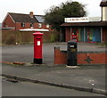
King George VI pillarbox and a litter bin on a Hardwicke corner
On the corner of Elmgrove Road East and Hildyard Close.
Little Monsters Childcare http://www.geograph.org.uk/photo/5261178 is in the background.
Image: © Jaggery
Taken: 22 Jan 2017
0.17 miles


