
IMAGES TAKEN NEAR TO
Fieldcourt Gardens, GLOUCESTER, GL2 4UA
Introduction
This page details the photographs taken nearby to Fieldcourt Gardens, GL2 4UA by members of the Geograph project.
The Geograph project started in 2005 with the aim of publishing, organising and preserving representative images for every square kilometre of Great Britain, Ireland and the Isle of Man.

There are currently over 7.5m images from over14,400 individuals and you can help contribute to the project by visiting https://www.geograph.org.uk
Image Map
Images are licensed for reuse under creativecommons.org/licenses/by-sa/2.0
Notes
- Clicking on the map will re-center to the selected point.
- The higher the marker number, the further away the image location is from the centre of the postcode.
Image Listing (18 Images Found)
Images are licensed for reuse under creativecommons.org/licenses/by-sa/2.0
Image
Details
Distance
1
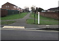
Path on the south side of School Lane, Quedgeley
Between Chiltern Road (on the right) and Courtfield Road.
Image: © Jaggery
Taken: 22 Jan 2017
0.16 miles
2
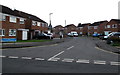
Courtfield Road, Quedgeley
From School Lane, Courtfield Road leads to Fieldcourt Farmhouse.
Image: © Jaggery
Taken: 22 Jan 2017
0.18 miles
3
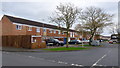
Brecon Close, Quedgeley
Quedgeley is a sprawling southern suburb of Gloucester.
Image: © Jonathan Billinger
Taken: 27 Dec 2012
0.19 miles
4
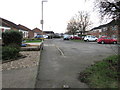
Chiltern Road, Quedgeley
From the south side of School Lane.
Image: © Jaggery
Taken: 22 Jan 2017
0.19 miles
5
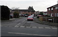
Druids Oak, Quedgeley
Cul-de-sac on the south side of School Lane.
Image: © Jaggery
Taken: 22 Jan 2017
0.21 miles
6
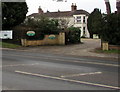
The Lawns Care Centre, Quedgeley
Set back from the west side of the B4008 Bristol Road.
Image: © Jaggery
Taken: 22 Jan 2017
0.21 miles
7
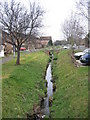
Watermeadows Quedgeley
Watermeadows is the Street name, the stream forms the district boundary with Hardwick in Stroud District to the left and Quedgeley in Gloucester to the right. This bit of Harwick can only be approached through Gloucester.
Image: © Peter Watkins
Taken: 3 Feb 2006
0.22 miles
8
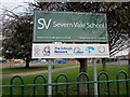
Severn Vale School nameboard, Quedgeley
Facing School Lane near this http://www.geograph.org.uk/photo/5514626 school exit.
Image: © Jaggery
Taken: 22 Jan 2017
0.22 miles
9
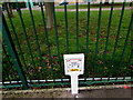
Oil pipeline marker, School Lane, Quedgeley
Alongside Severn Vale School perimeter railings.
Image: © Jaggery
Taken: 22 Jan 2017
0.22 miles
10
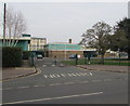
Exit from Severn Vale School, Quedgeley
NO ENTRY is painted on the road surface facing School Lane.
Image: © Jaggery
Taken: 22 Jan 2017
0.23 miles