
IMAGES TAKEN NEAR TO
Olympus Park, GLOUCESTER, GL2 4NF
Introduction
This page details the photographs taken nearby to Olympus Park, GL2 4NF by members of the Geograph project.
The Geograph project started in 2005 with the aim of publishing, organising and preserving representative images for every square kilometre of Great Britain, Ireland and the Isle of Man.

There are currently over 7.5m images from over14,400 individuals and you can help contribute to the project by visiting https://www.geograph.org.uk
Image Map
Images are licensed for reuse under creativecommons.org/licenses/by-sa/2.0
Notes
- Clicking on the map will re-center to the selected point.
- The higher the marker number, the further away the image location is from the centre of the postcode.
Image Listing (21 Images Found)
Images are licensed for reuse under creativecommons.org/licenses/by-sa/2.0
Image
Details
Distance
3
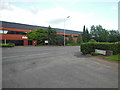
The home of the gods
The Olympus Business park contains buildings named after Athena and Apollo.
Image: © HelenK
Taken: 20 Jun 2016
0.13 miles
5
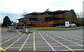
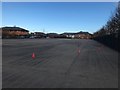
Olympus Park, Quedgeley, Gloucester
Business centre viewed across Bristol Road.
Image: © Jaggery
Taken: 13 Apr 2012
0.14 miles
6
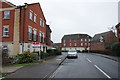
Streamside, Quedgeley
Recent housing development at Quedgeley on the southern edge of Gloucester.
Image: © Philip Halling
Taken: 26 Jan 2013
0.16 miles
7
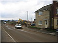
New housing, RAF Quedgeley
View south from the northern reaches of this ex military depot, rapidly disappearing under new housing
Image: © Peter Watkins
Taken: 21 Feb 2006
0.16 miles
8
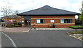
Quedgeley Driving Test Centre in Gloucester
Located in Falcon Close. In 2011, Department for Transport figures showed that only 152 out of 340 driving test centres in England, Wales and Scotland recorded pass rates of at least 50 per cent.
The figures for Quedgeley showed a failure rate of 53% for those taking their first test. The figure was 54% at the Cheltenham test centre.
Image: © Jaggery
Taken: 13 Apr 2012
0.17 miles
9
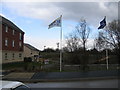
Access to new housing from Bodiam Avenue, Tuffley
View north from entrance road to ex-RAF Quedgeley housing, note mobile phone forest. A stream passes underneath, much diverted from the route on the 1940s map. Despite the gloom, it was midday.
Image: © Peter Watkins
Taken: 21 Feb 2006
0.18 miles
10

Daniel's Brook
The urban spread of Gloucester has engulfed Quedgeley and Daniel's Brook, pictured here.
Image: © Philip Halling
Taken: 26 Jan 2013
0.19 miles