
IMAGES TAKEN NEAR TO
Queens Road, TEWKESBURY, GL20 5EZ
Introduction
This page details the photographs taken nearby to Queens Road, GL20 5EZ by members of the Geograph project.
The Geograph project started in 2005 with the aim of publishing, organising and preserving representative images for every square kilometre of Great Britain, Ireland and the Isle of Man.

There are currently over 7.5m images from over14,400 individuals and you can help contribute to the project by visiting https://www.geograph.org.uk
Image Map
Images are licensed for reuse under creativecommons.org/licenses/by-sa/2.0
Notes
- Clicking on the map will re-center to the selected point.
- The higher the marker number, the further away the image location is from the centre of the postcode.
Image Listing (46 Images Found)
Images are licensed for reuse under creativecommons.org/licenses/by-sa/2.0
Image
Details
Distance
1

Queen Margaret Primary School, Prior's Park
Older-style school buildings in a central location for the Prior's Park estate on the southern outskirts of Tewkesbury.
Image: © Jonathan Billinger
Taken: 21 Aug 2012
0.06 miles
2
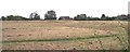
Margaret's Camp
Where, on the night of the 3rd of May 1471, Margaret (Henry VI's Queen) camped with her troops before the Battle of Tewkesbury.
Image: © Bob Embleton
Taken: 21 Jun 2005
0.08 miles
3
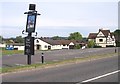
Gupshill Manor
On or very close to the site of the Battle of Tewkesbury 1471. Originally built in 1438.
Image: © Bob Embleton
Taken: 21 Jun 2005
0.08 miles
4
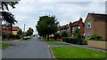
York Road, Prior's Park
An older-style estate on the southern outskirts of Tewkesbury.
Image: © Jonathan Billinger
Taken: 21 Aug 2012
0.09 miles
5
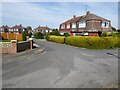
Houses on York Road
Houses with M=mansard roofs on York Road.
Image: © Philip Halling
Taken: 24 Apr 2021
0.09 miles
6
Margaret's Camp gate
This area of the Gastons has been developed somewhat over the latter part of the twentieth century. The core of the earthworks remain open to the public, however. For the time being at least!
Image: © Neil Owen
Taken: 10 Mar 2014
0.10 miles
7
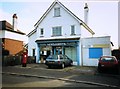
Abbot's Road Stores
This was a long established general store which closed around c1999. The shop was converted into a residential dwelling, the post box was moved to the junction of Abbot's Road and Foresters Road.
Image: © Helen Iwanczuk
Taken: Unknown
0.11 miles
8
Margaret's Camp
Margaret's Camp at Gupshill, this is the site of a former moated manor house and was probably already gone at the time of the Battle of Tewkesbury in 1471.
Image: © Philip Halling
Taken: 24 Apr 2021
0.12 miles
9
Margaret's Camp
Margaret's Camp at Gupshill, this is the site of a former moated manor house and was probably already gone at the time of the Battle of Tewkesbury in 1471.
Image: © Philip Halling
Taken: 24 Apr 2021
0.12 miles
10
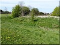
Margaret's Camp
Margaret's Camp at Gupshill, this is the site of a former moated manor house and was probably already gone at the time of the Battle of Tewkesbury in 1471.
Image: © Philip Halling
Taken: 24 Apr 2021
0.13 miles