
IMAGES TAKEN NEAR TO
Cinderhill, COLEFORD, GL16 8HL
Introduction
This page details the photographs taken nearby to Cinderhill, GL16 8HL by members of the Geograph project.
The Geograph project started in 2005 with the aim of publishing, organising and preserving representative images for every square kilometre of Great Britain, Ireland and the Isle of Man.

There are currently over 7.5m images from over14,400 individuals and you can help contribute to the project by visiting https://www.geograph.org.uk
Image Map
Images are licensed for reuse under creativecommons.org/licenses/by-sa/2.0
Notes
- Clicking on the map will re-center to the selected point.
- The higher the marker number, the further away the image location is from the centre of the postcode.
Image Listing (278 Images Found)
Images are licensed for reuse under creativecommons.org/licenses/by-sa/2.0
Image
Details
Distance
1
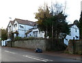
Horse silhouettes, Coleford
There are several silhouettes on the wall of this Cinder Hill house.
Image: © Jaggery
Taken: 12 Dec 2011
0.00 miles
2
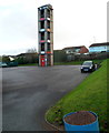
Coleford Fire Station tower
The training tower is in the yard on the south side of the fire station. http://www.geograph.org.uk/photo/3259176
Image: © Jaggery
Taken: 12 Dec 2011
0.03 miles
3
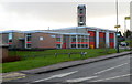
Coleford Fire Station viewed from the north
Coleford Community Fire and Rescue Station is located on the east side of Cinder Hill.
It is part of Gloucestershire Fire & Rescue Service.
Image: © Jaggery
Taken: 12 Dec 2011
0.03 miles
4
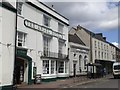
The Angel, Coleford
An historic coaching inn
Image: © Joss O'Kelly
Taken: Unknown
0.03 miles
5

The Martians have landed in Coleford
Looking like a flying saucer, this is Brunston Surgery, built in 1993. Viewed across Cinder Hill.
Image: © Jaggery
Taken: 12 Dec 2011
0.03 miles
6
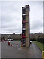
Coleford Fire Station Tower
Exercise Time
Image: © Peter Randall-Cook
Taken: 28 Jan 2013
0.03 miles
7
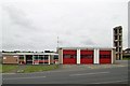
Coleford Fire Station
Coleford Fire Station, Cinderhill, Coleford is part of Gloucestershire Fire & Rescue Service
Image: © Kevin Hale
Taken: 3 Jun 2007
0.04 miles
8
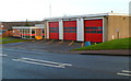
Coleford Fire Station viewed from the south
Coleford Community Fire and Rescue Station is located on the east side of Cinder Hill.
It is part of Gloucestershire Fire & Rescue Service.
Image: © Jaggery
Taken: 12 Dec 2011
0.04 miles
9
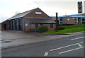
Coleford Ambulance Station
Located on the east side of Cinder Hill, next to the fire station. http://www.geograph.org.uk/photo/3259187
The name shown on the building is Great Western Ambulance Service (a National Health Service trust formed in April 2006 from the merger of the Avon, Gloucestershire and Wiltshire ambulance services.)
Image: © Jaggery
Taken: 12 Dec 2011
0.05 miles
10
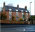
Forest House & Bluebell Restaurant, Coleford
Guest house and restaurant on the west side of Cinder Hill.
Forest House is a Grade II listed late Georgian building.
Image: © Jaggery
Taken: 12 Dec 2011
0.05 miles