
IMAGES TAKEN NEAR TO
Oakfields, COLEFORD, GL16 8EN
Introduction
This page details the photographs taken nearby to Oakfields, GL16 8EN by members of the Geograph project.
The Geograph project started in 2005 with the aim of publishing, organising and preserving representative images for every square kilometre of Great Britain, Ireland and the Isle of Man.

There are currently over 7.5m images from over14,400 individuals and you can help contribute to the project by visiting https://www.geograph.org.uk
Image Map
Images are licensed for reuse under creativecommons.org/licenses/by-sa/2.0
Notes
- Clicking on the map will re-center to the selected point.
- The higher the marker number, the further away the image location is from the centre of the postcode.
Image Listing (58 Images Found)
Images are licensed for reuse under creativecommons.org/licenses/by-sa/2.0
Image
Details
Distance
1
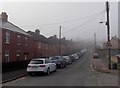
Into the fog along Albert Road, Coleford
Viewed from near the Oakfields junction on an October morning of patchy fog.
Image: © Jaggery
Taken: 12 Oct 2014
0.06 miles
2
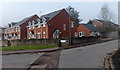
Oakfields, Coleford
Viewed from Albert Road. Oakfields leads to Meads Close. http://www.geograph.org.uk/photo/4203218
Image: © Jaggery
Taken: 12 Oct 2014
0.07 miles
3
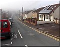
Albert Road, Coleford
Looking SW from the Staunton Road end.
Image: © Jaggery
Taken: 12 Oct 2014
0.08 miles
4
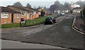
Meads Close, Coleford
Viewed from Oakfields.
Image: © Jaggery
Taken: 12 Oct 2014
0.10 miles
5

Thurstan's Rise, Coleford
David Wilson Homes house construction in progress on a foggy day in October 2014, on the SW side of Staunton Road in the NW of Coleford.
Image: © Jaggery
Taken: 12 Oct 2014
0.10 miles
6
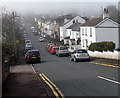
Victoria Road, Coleford
Viewed from the Staunton Road end looking SW on a foggy October morning.
Image: © Jaggery
Taken: 12 Oct 2014
0.12 miles
7
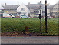
Ordnance Survey cut mark stone alongside Staunton Road, Coleford
The cut mark is a horizontal line above a vertical arrow on the stone.
The houses are in Sunnybank Road.
Image: © Jaggery
Taken: 12 Oct 2014
0.13 miles
8
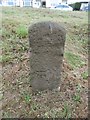
Old Milestone by the B4228, Staunton Road, Coleford
Carved stone post by the B4228, in parish of Coleford (Forest of Dean District), Staunton Road, opposite No. 45 on grassy embankment, on North-east side of road. MSTC, erected by the Monmouth Turnpike Trust in the 19th century.
The eroded inscription once read:-
(Monmouth 5)
Carved benchmark on lower front.
Milestone Society National ID: GL_MOSTCO05A.
Image: © Milestone Society
Taken: 14 Oct 2018
0.13 miles
9
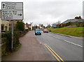
Road from Coleford to Staunton and Monmouth
Staunton Road (B4228) climbs away from central Coleford towards the A4136 which it meets about a mile away, at Robin Hood junction. Turn right 100 metres ahead for Ross-on-Wye, Symonds Yat and Berry Hill.
Image: © Jaggery
Taken: 12 Dec 2011
0.13 miles
10
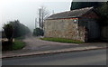
Owen Farm access road near Coleford
From the B4228 Staunton Road. The main farm buildings are 350 metres ahead.
Image: © Jaggery
Taken: 12 Oct 2014
0.14 miles