
IMAGES TAKEN NEAR TO
South Road, COLEFORD, GL16 8EJ
Introduction
This page details the photographs taken nearby to South Road, GL16 8EJ by members of the Geograph project.
The Geograph project started in 2005 with the aim of publishing, organising and preserving representative images for every square kilometre of Great Britain, Ireland and the Isle of Man.

There are currently over 7.5m images from over14,400 individuals and you can help contribute to the project by visiting https://www.geograph.org.uk
Image Map
Images are licensed for reuse under creativecommons.org/licenses/by-sa/2.0
Notes
- Clicking on the map will re-center to the selected point.
- The higher the marker number, the further away the image location is from the centre of the postcode.
Image Listing (64 Images Found)
Images are licensed for reuse under creativecommons.org/licenses/by-sa/2.0
Image
Details
Distance
1
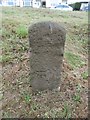
Old Milestone by the B4228, Staunton Road, Coleford
Carved stone post by the B4228, in parish of Coleford (Forest of Dean District), Staunton Road, opposite No. 45 on grassy embankment, on North-east side of road. MSTC, erected by the Monmouth Turnpike Trust in the 19th century.
The eroded inscription once read:-
(Monmouth 5)
Carved benchmark on lower front.
Milestone Society National ID: GL_MOSTCO05A.
Image: © Milestone Society
Taken: 14 Oct 2018
0.05 miles
2
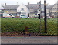
Ordnance Survey cut mark stone alongside Staunton Road, Coleford
The cut mark is a horizontal line above a vertical arrow on the stone.
The houses are in Sunnybank Road.
Image: © Jaggery
Taken: 12 Oct 2014
0.05 miles
3
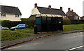
Bus shelter and litter bin, The Gorse, Coleford
Located between The Gorse (the main road) on this side and houses in Sunnybank Road.
Image: © Jaggery
Taken: 23 Nov 2014
0.06 miles
4
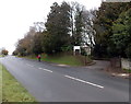
Entrance to The Coombs, Coleford
From The Gorse. The Coombs care home http://www.geograph.org.uk/photo/4258412 is Grade II listed.
Image: © Jaggery
Taken: 23 Nov 2014
0.07 miles
5
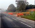
Roadside mirror, Staunton Road, Coleford
Recently installed for the use of vehicles leaving this http://www.geograph.org.uk/photo/4206513 building site.
Image: © Jaggery
Taken: 12 Oct 2014
0.08 miles
6
Meads Close, Coleford
Viewed from Oakfields.
Image: © Jaggery
Taken: 12 Oct 2014
0.08 miles
7
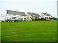
Sunny bank
Housing on Sunnybank Road overlooking Coleford from the north.
Image: © Jonathan Billinger
Taken: 6 Aug 2009
0.08 miles
8
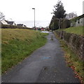
Concrete post, Sparrow Hill, Coleford
At the northern end of Sparrow Hill, near The Gorse junction,
the post prevents the passage of motor vehicles.
Image: © Jaggery
Taken: 23 Nov 2014
0.09 miles
9
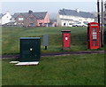
Four boxes alongside a path in Coleford
On the corner of Staunton Road and The Gorse. From left to right are a dark green telecoms box, a greyish box for the postie to store letters during a delivery round, a King George V postbox and a doorless phonebox. http://www.geograph.org.uk/photo/4203239
Image: © Jaggery
Taken: 12 Oct 2014
0.09 miles
10
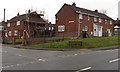
Bench on a suburban corner in Coleford
Viewed across The Gorse towards the corner of Buchanan Avenue.
Image: © Jaggery
Taken: 23 Nov 2014
0.09 miles