
IMAGES TAKEN NEAR TO
Albert Road, COLEFORD, GL16 8DY
Introduction
This page details the photographs taken nearby to Albert Road, GL16 8DY by members of the Geograph project.
The Geograph project started in 2005 with the aim of publishing, organising and preserving representative images for every square kilometre of Great Britain, Ireland and the Isle of Man.

There are currently over 7.5m images from over14,400 individuals and you can help contribute to the project by visiting https://www.geograph.org.uk
Image Map
Images are licensed for reuse under creativecommons.org/licenses/by-sa/2.0
Notes
- Clicking on the map will re-center to the selected point.
- The higher the marker number, the further away the image location is from the centre of the postcode.
Image Listing (178 Images Found)
Images are licensed for reuse under creativecommons.org/licenses/by-sa/2.0
Image
Details
Distance
1
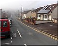
Albert Road, Coleford
Looking SW from the Staunton Road end.
Image: © Jaggery
Taken: 12 Oct 2014
0.02 miles
2
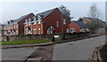
Oakfields, Coleford
Viewed from Albert Road. Oakfields leads to Meads Close. http://www.geograph.org.uk/photo/4203218
Image: © Jaggery
Taken: 12 Oct 2014
0.02 miles
3
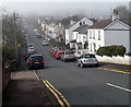
Victoria Road, Coleford
Viewed from the Staunton Road end looking SW on a foggy October morning.
Image: © Jaggery
Taken: 12 Oct 2014
0.06 miles
4
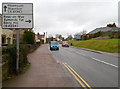
Road from Coleford to Staunton and Monmouth
Staunton Road (B4228) climbs away from central Coleford towards the A4136 which it meets about a mile away, at Robin Hood junction. Turn right 100 metres ahead for Ross-on-Wye, Symonds Yat and Berry Hill.
Image: © Jaggery
Taken: 12 Dec 2011
0.06 miles
5
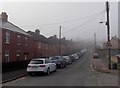
Into the fog along Albert Road, Coleford
Viewed from near the Oakfields junction on an October morning of patchy fog.
Image: © Jaggery
Taken: 12 Oct 2014
0.07 miles
6
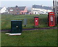
Four boxes alongside a path in Coleford
On the corner of Staunton Road and The Gorse. From left to right are a dark green telecoms box, a greyish box for the postie to store letters during a delivery round, a King George V postbox and a doorless phonebox. http://www.geograph.org.uk/photo/4203239
Image: © Jaggery
Taken: 12 Oct 2014
0.07 miles
7
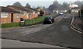
Meads Close, Coleford
Viewed from Oakfields.
Image: © Jaggery
Taken: 12 Oct 2014
0.08 miles
8
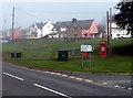
Junction for Berry Hill, Coleford
Viewed across Staunton Road. The sign pointing right shows
1 (mile) to Berry Hill, 3½ to Symonds Yat and 12 to Ross-on-Wye.
Image: © Jaggery
Taken: 12 Oct 2014
0.08 miles
9
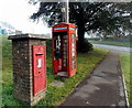
Path past a postbox and phonebox in Coleford
On the corner of Staunton Road and The Gorse. Two unanswered questions are why is the postbox so big in a suburban location? and what happened to the phonebox door?
Image: © Jaggery
Taken: 12 Oct 2014
0.08 miles
10
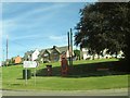
Houses on Sunnybank Road Coleford
Turning on to The Gorse to Berry Hill
Image: © Martin Dawes
Taken: 16 Aug 2016
0.08 miles