
IMAGES TAKEN NEAR TO
Lakers Road, COLEFORD, GL16 7QT
Introduction
This page details the photographs taken nearby to Lakers Road, GL16 7QT by members of the Geograph project.
The Geograph project started in 2005 with the aim of publishing, organising and preserving representative images for every square kilometre of Great Britain, Ireland and the Isle of Man.

There are currently over 7.5m images from over14,400 individuals and you can help contribute to the project by visiting https://www.geograph.org.uk
Image Map
Images are licensed for reuse under creativecommons.org/licenses/by-sa/2.0
Notes
- Clicking on the map will re-center to the selected point.
- The higher the marker number, the further away the image location is from the centre of the postcode.
Image Listing (76 Images Found)
Images are licensed for reuse under creativecommons.org/licenses/by-sa/2.0
Image
Details
Distance
1

Berry Hill Rugby Club clubhouse
Viewed from Lakers Road, Berry Hill.
Image: © Jaggery
Taken: 23 Nov 2014
0.04 miles
3
Orchard Way, Berry Hill
Looking across Park Road past Berry Hill Memorial Institute on the right. http://www.geograph.org.uk/photo/4295201
Berry Hill Rugby Club is in the background.
Image: © Jaggery
Taken: 23 Nov 2014
0.04 miles
4
Corner of Park Road and Lakers Road, Berry Hill
The corner building is Berry Hill Memorial Institute. http://www.geograph.org.uk/photo/4295201
Lakers Road (ahead on the right) leads to Berry Hill Rugby Club. http://www.geograph.org.uk/photo/4295400
Image: © Jaggery
Taken: 23 Nov 2014
0.04 miles
5

Berry Hill Memorial Institute
Community centre on the corner of Park Road and Orchard Way in Berry Hill.
Image: © Jaggery
Taken: 23 Nov 2014
0.04 miles
6

Stagecoach double-decker in Berry Hill
Travelling NW along Park Road.
Image: © Jaggery
Taken: 23 Nov 2014
0.04 miles
7
Chapel Cottage B&B, Berry Hill
Bed & breakfast accommodation in Chapel Road, next door to
Zion Apartments http://www.geograph.org.uk/photo/4295354 which were formerly a Methodist chapel.
Image: © Jaggery
Taken: 23 Nov 2014
0.07 miles
9
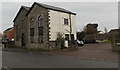
Zion Apartments, Berry Hill
Viewed across Chapel Road from the corner of Coverham Close. This was a former Methodist Chapel which has been converted into six apartments. An 1881 Ordnance Survey map shows it as Zion Chapel (Primitive Methodist). The building ceased being a place of worship in 1991.
Image: © Jaggery
Taken: 23 Nov 2014
0.09 miles
10

Frosted trees at Five Acres campus 1
A view of the western end of the college playing fields.
Image: © Jonathan Billinger
Taken: 10 Jan 2009
0.10 miles