IMAGES TAKEN NEAR TO
St. Briavels, LYDNEY, GL15 6TS
Introduction
This page details the photographs taken nearby to GL15 6TS by members of the Geograph project.
The Geograph project started in 2005 with the aim of publishing, organising and preserving representative images for every square kilometre of Great Britain, Ireland and the Isle of Man.

There are currently over 7.5m images from over14,400 individuals and you can help contribute to the project by visiting https://www.geograph.org.uk
Image Map
Images are licensed for reuse under creativecommons.org/licenses/by-sa/2.0
Notes
- Clicking on the map will re-center to the selected point.
- The higher the marker number, the further away the image location is from the centre of the postcode.
Image Listing (150 Images Found)
Images are licensed for reuse under creativecommons.org/licenses/by-sa/2.0
Image
Details
Distance
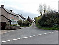
1
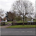
Junction of High Street and the B4228, St Briavels
Viewed from High Street.
Turn left onto the B4228 for Coleford (5 miles) and Berry Hill (6 miles).
Turn right for Hewelsfield (2 miles) and Chepstow (7 miles).
Image: © Jaggery
Taken: 12 May 2013
0.02 miles
2
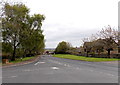
Barrowell Lane, St Briavels
Viewed from the corner of High Street.
Barrowell Lane is the name of this section of the B4228 in the village.
Image: © Jaggery
Taken: 12 May 2013
0.03 miles
3
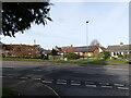
Looking across the B4228 from Hewelsfield Lane, St Briavels
Image: © Ruth Sharville
Taken: 11 Feb 2022
0.03 miles
6
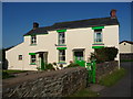
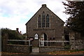
Spring Well cottage in St. Briavels
A very smart cottage in bright livery in the centre of the old village.
Image: © Jeremy Bolwell
Taken: 22 Jul 2012
0.05 miles
7
A plain and an ornate boundary sign, High Green, St Briavels
Located alongside the B4228 at the southern edge of the village.
A plaque on the base of the ornate sign states that it was erected in 1981, the year in which St Briavels won the Bledisloe Cup for the Gloucestershire Village of the Year competition. This area was cleared in 1980 and named High Green in a competition held at the village school. http://www.geograph.org.uk/photo/3462363 Trees were planted in October 1980 to commemorate Queens Elizabeth The Queen Mother's 80th birthday.
Image: © Jaggery
Taken: 12 May 2013
0.05 miles
8
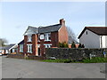
Former public house, which was the "Crown Inn", St Briavels
Image: © Ruth Sharville
Taken: 11 Feb 2022
0.06 miles
10
Crown Lane St Briavels
Viewed from High Street.
Image: © Jaggery
Taken: 12 May 2013
0.06 miles