A plain and an ornate boundary sign, High Green, St Briavels
Introduction
The photograph on this page of A plain and an ornate boundary sign, High Green, St Briavels by Jaggery as part of the Geograph project.
The Geograph project started in 2005 with the aim of publishing, organising and preserving representative images for every square kilometre of Great Britain, Ireland and the Isle of Man.

There are currently over 7.5m images from over 14,400 individuals and you can help contribute to the project by visiting https://www.geograph.org.uk
A plain and an ornate boundary sign, High Green, St Briavels
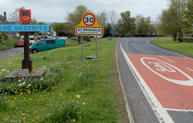
Image: © Jaggery Taken: 12 May 2013
Located alongside the B4228 at the southern edge of the village. A plaque on the base of the ornate sign states that it was erected in 1981, the year in which St Briavels won the Bledisloe Cup for the Gloucestershire Village of the Year competition. This area was cleared in 1980 and named High Green in a competition held at the village school. http://www.geograph.org.uk/photo/3462363 Trees were planted in October 1980 to commemorate Queens Elizabeth The Queen Mother's 80th birthday.
Images are licensed for reuse under creativecommons.org/licenses/by-sa/2.0
Image Location
Latitude
51.734852
Longitude
-2.640437