
IMAGES TAKEN NEAR TO
Coronation Road, CINDERFORD, GL14 3BZ
Introduction
This page details the photographs taken nearby to Coronation Road, GL14 3BZ by members of the Geograph project.
The Geograph project started in 2005 with the aim of publishing, organising and preserving representative images for every square kilometre of Great Britain, Ireland and the Isle of Man.

There are currently over 7.5m images from over14,400 individuals and you can help contribute to the project by visiting https://www.geograph.org.uk
Image Map
Images are licensed for reuse under creativecommons.org/licenses/by-sa/2.0
Notes
- Clicking on the map will re-center to the selected point.
- The higher the marker number, the further away the image location is from the centre of the postcode.
Image Listing (72 Images Found)
Images are licensed for reuse under creativecommons.org/licenses/by-sa/2.0
Image
Details
Distance
1
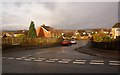
Westerley Close, Cinderford, Forest of Dean
This is the junction of Westerley Close and St White's Road. From up here, within a hundred yards of the Mount Pleasant public house, there are splendid distant views of the Forest towards the North and West, whilst to the South there is a mix of arable fields and more forest-scape.
Image: © Eric Soons
Taken: 11 Nov 2008
0.05 miles
2
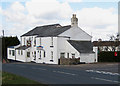
Mount Pleasant pub, Cinderford
On the B4226, Coleford Road, at its junction with Mount Pleasant Road.
Image: © Pauline E
Taken: 27 Mar 2008
0.06 miles
3
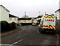
Lux van in Mount Pleasant Road, Cinderford
The van is a Lux highway maintenance vehicle.
Image: © Jaggery
Taken: 1 Mar 2015
0.06 miles
4
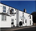
Mount Pleasant public house, Cinderford
Image: © nick macneill
Taken: 13 Oct 2012
0.07 miles
5
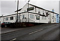
Mount Pleasant pub in Cinderford
Viewed across the B4226 St White's Road. The pub is on the corner of Mount Pleasant Road (ahead).
http://www.geograph.org.uk/photo/4366611 to a view of the name sign.
Image: © Jaggery
Taken: 1 Mar 2015
0.07 miles
6
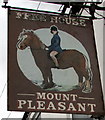
Mount Pleasant pub name sign, Cinderford
Located here. http://www.geograph.org.uk/photo/4366588 I didn't immediately relate the image to the name.
It was only when I recalled that mount can mean horse that the penny dropped.
Image: © Jaggery
Taken: 1 Mar 2015
0.07 miles
7
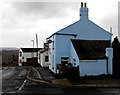
Blue corner of suburban Cinderford
The corner of Mount Pleasant Road and the Mount Pleasant pub http://www.geograph.org.uk/photo/4366588 at the edge of St White's Road.
Image: © Jaggery
Taken: 1 Mar 2015
0.07 miles
8
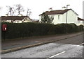
Postbox and hedge, Mount Pleasant Road, Cinderford
Near the Mount Pleasant pub. http://www.geograph.org.uk/photo/4366588
Image: © Jaggery
Taken: 1 Mar 2015
0.07 miles
9
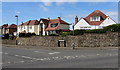
Abbots Road houses, Cinderford
Near the Littledean Parish boundary sign. http://www.geograph.org.uk/photo/4428237
Image: © Jaggery
Taken: 12 Apr 2015
0.07 miles
10
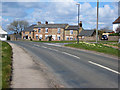
Stone cottages at the end of Abbots Road
Built from local Forest red sandstone.
Image: © Pauline E
Taken: 27 Mar 2008
0.08 miles