
IMAGES TAKEN NEAR TO
Mount Pleasant Road, CINDERFORD, GL14 3BX
Introduction
This page details the photographs taken nearby to Mount Pleasant Road, GL14 3BX by members of the Geograph project.
The Geograph project started in 2005 with the aim of publishing, organising and preserving representative images for every square kilometre of Great Britain, Ireland and the Isle of Man.

There are currently over 7.5m images from over14,400 individuals and you can help contribute to the project by visiting https://www.geograph.org.uk
Image Map
Images are licensed for reuse under creativecommons.org/licenses/by-sa/2.0
Notes
- Clicking on the map will re-center to the selected point.
- The higher the marker number, the further away the image location is from the centre of the postcode.
Image Listing (81 Images Found)
Images are licensed for reuse under creativecommons.org/licenses/by-sa/2.0
Image
Details
Distance
1
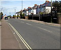
Belle Vue Road, Cinderford
Viewed from the corner of Abbots Road.
Image: © Jaggery
Taken: 12 Apr 2015
0.06 miles
2
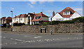
Abbots Road houses, Cinderford
Near the Littledean Parish boundary sign. http://www.geograph.org.uk/photo/4428237
Image: © Jaggery
Taken: 12 Apr 2015
0.06 miles
3
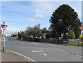
X-shaped crossroads in Cinderford
Roads aligned SW-NE and SE-NW cross here. The Give Way sign is at the NE end of Abbots Road,
on the corner of the A4151. Littledean Hill Road is on the far side of the A4151.
Image: © Jaggery
Taken: 12 Apr 2015
0.07 miles
4
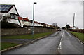
Abbots Road, Cinderford
Looking towards the A4151 Belle Vue Road.
Image: © Jaggery
Taken: 1 Mar 2015
0.07 miles
5
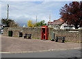
Corner of Littledean Hill Road and Belle Vue Road in Cinderford
The former phonebox is now only a box. http://www.geograph.org.uk/photo/4428233
Image: © Jaggery
Taken: 12 Apr 2015
0.07 miles
6
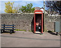
Former phonebox now only a box, Cinderford
The red box is on the corner of Littledean Hill Road and Belle Vue Road. http://www.geograph.org.uk/photo/4428234
In April 2015, the door seen here http://www.geograph.org.uk/photo/740959 in 2008, and the phone, have gone.
Image: © Jaggery
Taken: 12 Apr 2015
0.07 miles
7
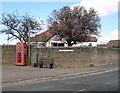
Phonebox at the end of Littledean Hill Road
Stone walls behind the box are built from local Forest red sandstone.
Image: © Pauline E
Taken: 27 Mar 2008
0.07 miles
8
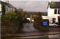
Mousel Lane, Cinderford, Forest of Dean
Darting off from Belle Vue Road in Cinderford is this little, somewhat curvaceous, lane. Surprisingly there is a closely packed string of dwellings on both sides of most of the lane as it tumbles down to merge with Woodside Street and Woodside Avenue into the junction of Church Road and Commercial Street.
Image: © Eric Soons
Taken: 11 Nov 2008
0.08 miles
9
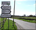
Littledean Parish boundary sign
Alongside the A4151, viewed from Cinderford.
Image: © Jaggery
Taken: 12 Apr 2015
0.08 miles
10
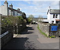
Eastern end of Mousel Lane, Cinderford
From Belle Vue Road. The lane is unsuitable for heavy goods vehicles.
Some maps show Mousell Lane. The name sign disagrees.
Image: © Jaggery
Taken: 12 Apr 2015
0.08 miles