
IMAGES TAKEN NEAR TO
Cedardean, CINDERFORD, GL14 2XW
Introduction
This page details the photographs taken nearby to Cedardean, GL14 2XW by members of the Geograph project.
The Geograph project started in 2005 with the aim of publishing, organising and preserving representative images for every square kilometre of Great Britain, Ireland and the Isle of Man.

There are currently over 7.5m images from over14,400 individuals and you can help contribute to the project by visiting https://www.geograph.org.uk
Image Map
Images are licensed for reuse under creativecommons.org/licenses/by-sa/2.0
Notes
- Clicking on the map will re-center to the selected point.
- The higher the marker number, the further away the image location is from the centre of the postcode.
Image Listing (167 Images Found)
Images are licensed for reuse under creativecommons.org/licenses/by-sa/2.0
Image
Details
Distance
1
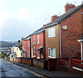
Parragate Road, Cinderford
Viewed from the Wesley Road and High Street end looking west.
According to various sources, this is the only Parragate Road in the UK.
Image: © Jaggery
Taken: 16 Dec 2012
0.09 miles
2

Scania lorry outside Lidl, Cinderford
Delivering supplies to the supermarket on a Sunday morning in August 2025.
Image: © Jaggery
Taken: 3 Aug 2025
0.10 miles
3

Unsuitable for heavy goods vehicles, Parragate Road, Cinderford
Looking west down Parragate Road. The broken white line
is at the exit from the Lidl supermarket car park.
Image: © Jaggery
Taken: 3 Aug 2025
0.10 miles
4

Lidl supermarket car park exit, Cinderford
Into Parragate Road. Turn right for the ascent to High Street.
Image: © Jaggery
Taken: 3 Aug 2025
0.11 miles
5
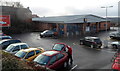
Lidl supermarket in Cinderford
Viewed from High Street.
Image: © Jaggery
Taken: 16 Dec 2012
0.11 miles
6
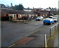
Rowandean bungalows, Cinderford
Viewed from the edge of Rowandean Court. http://www.geograph.org.uk/photo/3655583
Image: © Jaggery
Taken: 16 Dec 2012
0.11 miles
7

Cinderford Lidl
Lidl supermarket accessed from Parragate Road near High Street.
Image: © Jaggery
Taken: 3 Aug 2025
0.11 miles
9
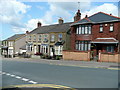
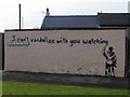
Station Road, Cinderford
Housing of varying styles and ages.
Image: © Jonathan Billinger
Taken: 7 Aug 2009
0.11 miles
10
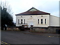
Miners Welfare Hall, Cinderford
Viewed across Wesley Road. The back of the hall faces Parragate Road.
Now used as a community hall and dance hall.
Image: © Jaggery
Taken: 16 Dec 2012
0.12 miles