IMAGES TAKEN NEAR TO
Forest Road, CINDERFORD, GL14 2NR

Introduction

This page details the photographs taken nearby to Forest Road, GL14 2NR by members of the Geograph project.

The Geograph project started in 2005 with the aim of publishing, organising and preserving representative images for every square kilometre of Great Britain, Ireland and the Isle of Man.

There are currently over 7.5m images from over14,400 individuals and you can help contribute to the project by visiting https://www.geograph.org.uk

Image Map


Images are licensed for reuse under creativecommons.org/licenses/by-sa/2.0
Notes
  • Clicking on the map will re-center to the selected point.
  • The higher the marker number, the further away the image location is from the centre of the postcode.

Image Listing (139 Images Found)

Images are licensed for reuse under creativecommons.org/licenses/by-sa/2.0
  • ...
Image
Details
Distance
1
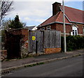
Forest Road electricity substation, Cinderford
The Western Power Distribution electricity substation is at the western edge of the Forest Road Centre. http://www.geograph.org.uk/photo/4426003
Image: © Jaggery Taken: 12 Apr 2015
0.01 miles
2
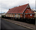
Forest Road Centre in Cinderford
The Forest Road building is near the corner of Abbey Street. Names on the building include Citizens Advice Bureau and St Stephens Hall.
Image: © Jaggery Taken: 12 Apr 2015
0.01 miles
3
Four aerials, four flats, Forest Road, Cinderford
Four aerials are on top of the pyramid-like roof of flats near the Woodside Street junction.
Image: © Jaggery Taken: 12 Apr 2015
0.04 miles
4
Woodside Street, Cinderford
A view south from the Abbey Street junction. At the left edge of the view is Kings Head Court, aptly adorned with a depiction of a king's head on the top of the building.
Image: © Jaggery Taken: 16 Dec 2012
0.04 miles
5
Kings Head Court
New houses on Abbey Street - the foremost house has a stained glass window displayed above the roof where you might expect to find a chimney. Information supplied by a site visitor. "There was a pub called the Kings Head there. The landlord at one time (probably late 1950's - early 60's) was Frank Popejoy."
Image: © Pauline E Taken: 17 Mar 2008
0.04 miles
6
Pembroke Street, Cinderford
From Flaxley Street looking past a Best One convenience store http://www.geograph.org.uk/photo/4425828 on the left.
Image: © Jaggery Taken: 12 Apr 2015
0.04 miles
7
Abbey Street, Cinderford
Looking SE from Woodside Street.
Image: © Jaggery Taken: 16 Dec 2012
0.05 miles
8
Forest Road, Cinderford
Forest Road climbs away from Commercial Street past the northern edge of Packers Road.
Image: © Jaggery Taken: 16 Dec 2012
0.06 miles
9
Best One in Cinderford
Convenience store on the corner of Flaxley Street and Pembroke Street.
Image: © Jaggery Taken: 12 Apr 2015
0.07 miles
10
Lamb Lane, Cinderford
Linking Commercial Street with Woodside Street.
Image: © Pauline E Taken: 17 Mar 2008
0.08 miles
  • ...