1
Abbey Street, Cinderford
From Flaxley Street.
Image: © Jaggery
Taken: 12 Apr 2015
0.00 miles
2
Pembroke Street, Cinderford
From Flaxley Street looking past a Best One convenience store http://www.geograph.org.uk/photo/4425828 on the left.
Image: © Jaggery
Taken: 12 Apr 2015
0.03 miles
3
Saint Anthony's School, Cinderford
An independent school in Belle Vue Road.
Image: © Pauline E
Taken: 17 Mar 2008
0.03 miles
4
Flaxley Street, Cinderford
Pretty steep drop down past St. Anthony's Church. Looking west towards the forest.
Image: © Pauline E
Taken: 17 Mar 2008
0.04 miles
5
West side of Our Lady of Victories Catholic Church in Cinderford
Viewed across Flaxley Street. St Anthony's School & Nursery http://www.geograph.org.uk/photo/4425720 are in the background.
Image: © Jaggery
Taken: 12 Apr 2015
0.04 miles
6
Flaxley Street, Cinderford
The eastern end of the street from the corner of Belle Vue Road.
Our Lady of Victories Catholic Church http://www.geograph.org.uk/photo/4425705 is on the right.
Image: © Jaggery
Taken: 12 Apr 2015
0.05 miles
7
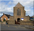
Our Lady of Victories Catholic Church in Cinderford
On the north side of Flaxley Street, near the corner of Abbey Street.
Image: © Jaggery
Taken: 12 Apr 2015
0.05 miles
8
Best One in Cinderford
Convenience store on the corner of Flaxley Street and Pembroke Street.
Image: © Jaggery
Taken: 12 Apr 2015
0.05 miles
9
St Anthony's School & Nursery, Cinderford
Viewed across Flaxley Street. Though the school has strong links with the adjacent Our Lady
of Victories Catholic Church, http://www.geograph.org.uk/photo/4425705 the school welcomes children of any faith, or none.
Image: © Jaggery
Taken: 12 Apr 2015
0.06 miles
10
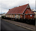
Forest Road Centre in Cinderford
The Forest Road building is near the corner of Abbey Street.
Names on the building include Citizens Advice Bureau and St Stephens Hall.
Image: © Jaggery
Taken: 12 Apr 2015
0.07 miles


