
IMAGES TAKEN NEAR TO
Parragate Road, CINDERFORD, GL14 2JZ
Introduction
This page details the photographs taken nearby to Parragate Road, GL14 2JZ by members of the Geograph project.
The Geograph project started in 2005 with the aim of publishing, organising and preserving representative images for every square kilometre of Great Britain, Ireland and the Isle of Man.

There are currently over 7.5m images from over14,400 individuals and you can help contribute to the project by visiting https://www.geograph.org.uk
Image Map
Images are licensed for reuse under creativecommons.org/licenses/by-sa/2.0
Notes
- Clicking on the map will re-center to the selected point.
- The higher the marker number, the further away the image location is from the centre of the postcode.
Image Listing (182 Images Found)
Images are licensed for reuse under creativecommons.org/licenses/by-sa/2.0
Image
Details
Distance
1
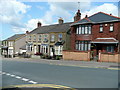
Station Road, Cinderford
Housing of varying styles and ages.
Image: © Jonathan Billinger
Taken: 7 Aug 2009
0.05 miles
2
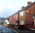
Parragate Road, Cinderford
Viewed from the Wesley Road and High Street end looking west.
According to various sources, this is the only Parragate Road in the UK.
Image: © Jaggery
Taken: 16 Dec 2012
0.08 miles
3
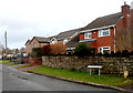
Station Terrace houses, Cinderford
Viewed from the corner of Station Street.
Image: © Jaggery
Taken: 16 Dec 2012
0.08 miles
4
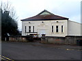
Miners Welfare Hall, Cinderford
Viewed across Wesley Road. The back of the hall faces Parragate Road.
Now used as a community hall and dance hall.
Image: © Jaggery
Taken: 16 Dec 2012
0.10 miles
5
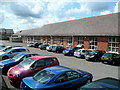
Ex-college building, Cinderford
View from College Road. Now superseded by the Royal Forest of Dean campus at Five Acres, Coleford.
Image: © Jonathan Billinger
Taken: 7 Aug 2009
0.10 miles
6
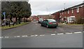
Houses on the site of the former Cinderford railway station
Viewed from Station Street. Houses in The Keelings are built
on the site of Cinderford railway station, where passenger services ceased in 1958.
Image: © Jaggery
Taken: 16 Dec 2012
0.12 miles
7

Scania lorry outside Lidl, Cinderford
Delivering supplies to the supermarket on a Sunday morning in August 2025.
Image: © Jaggery
Taken: 3 Aug 2025
0.12 miles
8
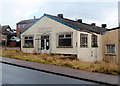
Forest Oaks Amateur Boxing Club gym, Cinderford
Located on the corner of Station Street and Barleycorn Square.
Image: © Jaggery
Taken: 16 Dec 2012
0.12 miles
9
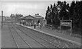
Cinderford station, 1950
View southward towards the buffer-stops of the terminus of the ex-GWR Forest of Dean branch from Newnham via Bullo Pill Junction, closed to passengers 3/11/1958, to goods 1/8/1967; until 8/7/1929 there had also been trains from Drybrook Road on the Severn& Wye Joint line from Lydbrook Junction.
Image: © Walter Dendy, deceased
Taken: 23 Sep 1950
0.13 miles
10
Lidl supermarket in Cinderford
Viewed from High Street.
Image: © Jaggery
Taken: 16 Dec 2012
0.13 miles