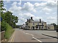
IMAGES TAKEN NEAR TO
The Sidings, WOTTON-UNDER-EDGE, GL12 8UF
Introduction
This page details the photographs taken nearby to The Sidings, GL12 8UF by members of the Geograph project.
The Geograph project started in 2005 with the aim of publishing, organising and preserving representative images for every square kilometre of Great Britain, Ireland and the Isle of Man.

There are currently over 7.5m images from over14,400 individuals and you can help contribute to the project by visiting https://www.geograph.org.uk
Image Map
Images are licensed for reuse under creativecommons.org/licenses/by-sa/2.0
Notes
- Clicking on the map will re-center to the selected point.
- The higher the marker number, the further away the image location is from the centre of the postcode.
Image Listing (94 Images Found)
Images are licensed for reuse under creativecommons.org/licenses/by-sa/2.0
Image
Details
Distance
1
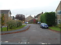
The Sidings, Charfield
Viewed from Station Road. The Sidings is a cul-de-sac of 11 houses
near the site of Charfield railway station which closed in 1965.
Image: © Jaggery
Taken: 28 Oct 2012
0.01 miles
2
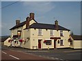
The Railway Inn
There no longer seems to be a railway station in Charfield, but the Railway Inn still stands on the corner of the B4058 and Station road.
Image: © Sharon Loxton
Taken: 3 Jul 2006
0.02 miles
3
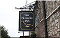
Plough Inn Sign, Wotton Road, Charfield, Gloucestershire 2014
Image: © Ray Bird
Taken: 11 Sep 2014
0.03 miles
4
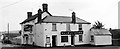
The Railway Tavern, Wotton Road, Charfield, Gloucestershire 2014
Image: © Ray Bird
Taken: 11 Sep 2014
0.04 miles
5
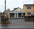
Kopperz, Charfield
Hair studio at 58 Wotton Road.
Image: © Jaggery
Taken: 28 Oct 2012
0.04 miles
6
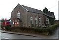
Charfield Congregational Church
On the corner of Wotton Road and Elbury View, Charfield.
Image: © Jaggery
Taken: 28 Oct 2012
0.04 miles
7
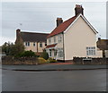
Houses on the corner of Station Road and Horsford Road, Charfield
The street name sign shows Horsford Road.
Image: © Jaggery
Taken: 28 Oct 2012
0.04 miles
8
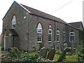
Charfield Congregational Church
Initially an Independent Chapel, this place of worship has outlived its neighbours - which included sheep pens and a police station in the past.
Image: © Neil Owen
Taken: 18 Apr 2019
0.05 miles
9
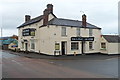
Railway Tavern, Charfield
On the corner of Wotton Road and Station Road, about 100 metres
north of Charfield railway station which closed in 1965.
Image: © Jaggery
Taken: 28 Oct 2012
0.05 miles