IMAGES TAKEN NEAR TO
Underhill Road, WOTTON-UNDER-EDGE, GL12 8TD
Introduction
This page details the photographs taken nearby to Underhill Road, GL12 8TD by members of the Geograph project.
The Geograph project started in 2005 with the aim of publishing, organising and preserving representative images for every square kilometre of Great Britain, Ireland and the Isle of Man.

There are currently over 7.5m images from over14,400 individuals and you can help contribute to the project by visiting https://www.geograph.org.uk
Image Map
Images are licensed for reuse under creativecommons.org/licenses/by-sa/2.0
Notes
- Clicking on the map will re-center to the selected point.
- The higher the marker number, the further away the image location is from the centre of the postcode.
Image Listing (104 Images Found)
Images are licensed for reuse under creativecommons.org/licenses/by-sa/2.0
Image
Details
Distance
1
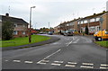
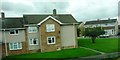
Manor Lane, Charfield
Viewed from Charfield Green. On the left, low metal barriers prevent vehicles parking on, or otherwise misusing, the green.
Image: © Jaggery
Taken: 28 Oct 2012
0.07 miles
3
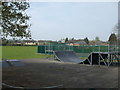
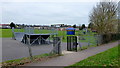
To keep the kids amused
Charfield's recreation field is supplied with some athletic facilities.
Image: © Neil Owen
Taken: 18 Apr 2019
0.10 miles
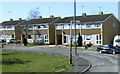
4
Charfield Green houses, Charfield
The road is named Charfield Green ahead, Little Bristol Lane behind the camera.
Image: © Jaggery
Taken: 28 Oct 2012
0.11 miles
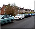
5
Housing estate at Charfield Green
Viewed from railway line and looking towards junction of Manor Lane and Charfield Green
Image: © Clint Mann
Taken: 3 Sep 2015
0.11 miles
7
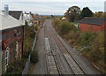
Railway passes the site of the former Charfield station
Viewed from this http://www.geograph.org.uk/photo/3728506 footbridge. The line from Gloucester to Bristol passes the site of Charfield station. Visible on the left in the middle distance, a platform http://www.geograph.org.uk/photo/3726431 and the main station buildings remain. Passenger services were withdrawn from Charfield in January 1965. Goods services ended later that year.
Image: © Jaggery
Taken: 28 Oct 2012
0.11 miles
8
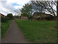
Charfield playing field
Children's play area viewed from the Little Bristol Lane.
Image: © Jonathan Billinger
Taken: 16 Mar 2012
0.11 miles
9
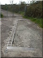
Set into the ground
An outline of some ironmongery along Station Road - possibly connected in the past with the adjoining railway?
Image: © Neil Owen
Taken: 18 Apr 2019
0.12 miles
10
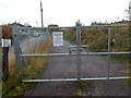
Gate across a railway access lane in Charfield
Viewed from Station Road. There is an Amey Colas warning notice on the locked gate.
Image: © Jaggery
Taken: 28 Oct 2012
0.12 miles