
IMAGES TAKEN NEAR TO
Bournstream, WOTTON-UNDER-EDGE, GL12 7DY
Introduction
This page details the photographs taken nearby to GL12 7DY by members of the Geograph project.
The Geograph project started in 2005 with the aim of publishing, organising and preserving representative images for every square kilometre of Great Britain, Ireland and the Isle of Man.

There are currently over 7.5m images from over14,400 individuals and you can help contribute to the project by visiting https://www.geograph.org.uk
Image Map
Images are licensed for reuse under creativecommons.org/licenses/by-sa/2.0
Notes
- Clicking on the map will re-center to the selected point.
- The higher the marker number, the further away the image location is from the centre of the postcode.
Image Listing (18 Images Found)
Images are licensed for reuse under creativecommons.org/licenses/by-sa/2.0
Image
Details
Distance
1
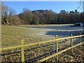
Pasture by Ellerncroft Road
Sheep consider the limited grazing possibilities in this frosty field on the slopes of Wotton Hill. On the left it is bordered by the lane up from Bradley Green to Bradley Road.
Image: © Derek Harper
Taken: 2 Jan 2010
0.09 miles
2
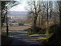
Lane to Bradley Green
The lane mentioned under Image, sunken and overhung with trees as it drops down the Cotswold scarp from Bradley Road, emerges into the open at a left turn to Corner Farm. Ahead is Image
Image: © Derek Harper
Taken: 2 Jan 2010
0.10 miles
3
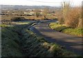
Lane to Bradley Green
The triangular green on the left, between arms of a no through road to Corner Farm, is not THE Bradley Green, although that is little more than 200 metres down the lane. The buildings, which are alongside it, are at Bradley Farm.
Image: © Derek Harper
Taken: 2 Jan 2010
0.12 miles
4
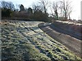
Frosty grass near Bradley Green
The triangular green seen on the left of Image, and an arm of the lane leading to Corner Farm.
Image: © Derek Harper
Taken: 2 Jan 2010
0.13 miles
5
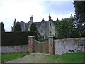
Bradley Court
Located to the west of Wotton-under-edge.
Image: © Roger Cornfoot
Taken: 19 Feb 2007
0.14 miles
6
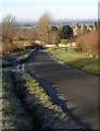
Lane past Bradley Court
A view around the bend shown in Image Bradley Court, on the right with its prominent chimeystacks, is a C16 manor house, and "belonged to the Berkeley family until 1611. This manor house replaced an earlier moated house some distance to the north. The house was acquired by Thomas Dawes (d.1713) in 1692 who was responsible for carrying out alterations to the house and grounds. The house was extensively conserved in 1984 by Rory Young" http://www.imagesofengland.org.uk/Details/Default.aspx?id=128047&mode=adv .
Image: © Derek Harper
Taken: 2 Jan 2010
0.15 miles
7
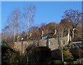
Terrace on Bradley Road, Wotton-Under-Edge
The rear of a C19 terrace of four, seen from Ellerncroft Road. On the slopes of Wotton Hill, the houses are a good deal higher at the back than the front http://www.imagesofengland.org.uk/Details/Default.aspx?id=128051&mode=adv .
Image: © Derek Harper
Taken: 2 Jan 2010
0.20 miles

9
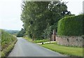
Minor road near Bradley Court
Looking westwards.
Image: © Ruth Riddle
Taken: 21 Jul 2012
0.20 miles
10
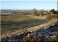
Bradley Green
On the right is the lane and manor house shown in Image; on the left, the buildings at Bradley farm visible in Image This view is from the same spot as Image
Image: © Derek Harper
Taken: 2 Jan 2010
0.20 miles